StudentShare
Contact Us
Sign In / Sign Up for FREE
Search
Go to advanced search...
Free

Analysis of Green Space and its Accessibility in AL-Madinah City, Saudi Arabia, - Essay Example

Cite this document
Summary
Green spaces are of great importance both for ecological balance and for the health of individuals.They play a fundamental role in providing opportunities for rest, relaxation and enjoying the beauty of nature for the urban population wishing to escape the daily stresses of urban life…
Download full paper File format: .doc, available for editing
GRAB THE BEST PAPER98.4% of users find it useful
Analysis of Green Space and its Accessibility in AL-Madinah City, Saudi Arabia,
Read Text Preview

Extract of sample "Analysis of Green Space and its Accessibility in AL-Madinah City, Saudi Arabia,"

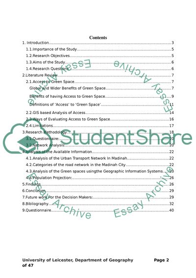
? “Distribution Pattern Analysis of Green Space and its Accessibility in AL-Madinah Saudi Arabia, Using Geographic Information Systems (GIS) Technique” Postraduate Researcher 22 / 09/ 2012 Contents 1. Introduction 3 1.1.Importance of the Study 5 1.2.Research Objectives 5 1.3.Aims of the Study 6 1.4.Research Questions 6 2.Literature Review 7 2.1.Access to Green Space 7 Global and Wider Benefits of Green Space 7 Benefits of having Access to Green Space 9 Definitions of ‘Access’ to ‘Green Space’ 10 2.2.GIS based Analysis of Access 14 2.3.Ways of Evaluating Access to Green Space 15 2.4.Limitations 16 3.Research Methodology 17 3.1.Questionnaire: 19 3.2.Network Analysis: 19 4.Analysis of the Available Information 21 4.1.Analysis of the Urban Transport Network In Madinah 21 4.2.Categories of the road network in the Madinah City 21 4.3.Analysis of the Green spaces usingthe Geographic Information Systems 22 4.4.Population Projection: 25 5.Findings 25 6.Conclusion 28 7.Future work For the Decision Makers: 28 8.Bibliography 31 9.Questionnaire 39 1. Introduction Green spaces1 are of great importance both for ecological balance and for the health of individuals (Heidt and Neef, 2008). They play a fundamental role in providing opportunities for rest, relaxation and enjoying the beauty of nature for the urban population wishing to escape the daily stresses of urban life. Moreover, green spaces facilitate sport and leisure activities. In reference to the ecological benefits green space absorbs and expels pollutants from the environment, by acting as an urban heat sink thereby protecting urban biodiversity. Green spaces are important for improving the air quality during the day, ridding it of carbon dioxide and other pollutants; they also beautify the environment, create a soothing atmosphere, and protect people from the glare and heat of the sun (Kumagai, 2011; Masakazu, 2003; Heidt and Neef, 2008; Loures, R. Santos and P. Thomas, 2007; Altunkasa and Uslu, 2004). This research will develop and extend current methods for the spatial analysis of patterns of green space accessibility with regards to all segments of the population in Madinah, Saudi Arabia. Increasing rates of urbanization in Madinah have led to increased pressure on many of the services and facilities, especially green spaces and gardens which are a key requirement for high density neighborhoods as they beneficial for the human life and for the environment as well. Thus, there is need to analyze these patterns and accessibility in order to guide green space planning both now and into the future. The huge evolution in Geographic Information Systems techniques (Spatial Analysis, Modelling, Spatial Assessment, Network analysis) can be used to analysis the accessibility to green spaces. During GIS analysis of access to green space, it is imperative to compare the official classification of land area with the land use pattern on the ground. According to Chang (2008), classifying land portion is a viable method of appreciating land use in an area. Chang (2008), in his study, analyzes the accessibility of green space in terms of land area use. He compared the land use matrices in different areas in order to ascertain green space accessibility by considering the impact of different land uses over the accessibility of green spaces (Chang, 2008). Chang (2008) found that the impacts of land use, such as commercial and industrial activities, are directly proportional to area dweller’s access to the green space. The aim of this research is to analyse: [1] the geographical distribution of green spaces and [2] the factors that affect accessibility to green spaces to ensure that any future development addresses the issue of equitable distribution and access to parks and green spaces. The study will analyze the geographical distribution of green spaces and their facilities in Madinah by collecting relevant data from various parks of the city. The results will be represented through tables, graphs, and maps to show the pattern of geographical distribution, and to facilitate its comparison and interpretation. In this regard, the following statistical and qualitative methods will be used: 1- ‘Network and Spatial Analysis’ will be used to determine the best accessibility routes. 2- Data Collection will be done through ‘Questionnaire’ survey. 3- ‘Geostatistical Analysis’ will be used for population estimation and prediction In the context of spatial analysis of green space, GIS analyses can be used to assess the accessibility of urban green spaces by selecting and quantifying factors that affect green space and constructing functions to determine the accessibility indicator (Comber, Brunsdon and Green , 2008). These factors include attraction to green space, population distribution, traffic patterns and pattern of land use in the area (Ritsema & De, 2003). GIS analysis of green space accessibility demonstrates to state planners the rate of green space accessibility in terms of spatial distribution (Maguire, Goodchild & Batty, 2005). 1.1. Importance of the Study The past studies assert that the available green spaces in Al-Madinah are not enough to meet the human needs, particularly the number public parks is very inadequate (Hemdan, 2008). Faouz (2010), in his study, refer to the random distribution of green spaces in the parts of the Madinah city which need re-distribution and maintenance. This investigation is meant to assess the current position of green spaces in Madinah city using GIS techniques and to determine the capability of current green spaces to meet the future demands, if it does not aim to provide any proposals for future access to green spaces within the Madinah region. Since the changes in population have a proportional effect on access to green spaces, it is paramount that population shifts are assessed for a certain period of time. This research will develop a projection of Madinah’s population from 2010 to 2050. The essence of choosing this gap was to provide sufficient time to the decision makers to access the current green spaces and plan for the future use of these available green spaces (Michael 2004, 143). 1.2. Research Objectives The basic objective of this study is to achieve the results and outputs that could contribute to explaining the pattern of geographical distribution, and help the planners to identify the pros and cons of that distribution along withproviding assistance to them in the future planning for the prevention of the negative impact of the current distribution pattern. In doing so, this research will investigate the role of geographical information systems software in identifying geographical patterns of distribution of the phenomena, assisting in forecasting the future of distribution, and reducing the negative effects of that distribution. In this regard, this study will pursue the following objectives: 1. Quantify the spatial distribution of greenspaces in relation to the demand of Saudi and non-Saudi population. 2. Develop models of future demand (changes in future population or target green space users) 3. Develop methods for optimising green space distribution (locations) based on changing demand 1.3. Aims of the Study The aims of this research are: 1. To quantify and compare access to green spaces for Saudi and non-Saudi groups in Madinah 2. To develop methods for examining the impacts of predicted population changes on spatial planning. 3. To develop questionnaire analyses for planners and for the public perceptions and compare the results spatially and statistically. 4. To integrate the results of the GIS and the questionnaire perceptions into a spatial analysis to support spatial decision making. 1.4. Research Questions 1. How well does Saudi and non-Saudi groups access green spaces in Madinah? 2. How best can the future population of Saudi and non-Saudi in Madinah be examined in relation to green space access? 3. What are the optimal locations of green spaces in relation to future population of Saudi and non-Saudi in Madinah? 4. How best can the results of the questionnaire analyses be compared statistically and spatially? 2. Literature Review 2.1. Access to Green Space Global and Wider Benefits of Green Space The global and wider benefits of urban green space (UGS) can be broadly classified in to two categories that are: (a) Environmental Benefits, such as the ecological benefits, pollution control, biodiversity and nature conservation, and (b) Economic and Aesthetic Benefits, such as the energy savings and property value. Each of these benefits of UGS has been described below: Ecological Benefits UGS provides ecosystem services to urban areas, which range from the maintenance of biodiversity to the climate regulation. In contrast to the rural areas, the urban areas usually have differences in solar input, temperature and rainfall pattern. The built environment in the cities causes the solar radiation, wind speed, air temperature and relative humidity to change (Heidt and Neef, 2008). Urban heat island effect is created as a result of the huge portions of heat absorbing surfaces combined with the high usage of energy in the cities, due to which the urban temperatures can be increased by 5°C (Bolund and Sven, 1999). Hence, the sufficient vegetation, forest plantation across the cities and management of water bodies by authorities can reduce these adverse effects to a significant extent. Pollution Control Urban areas are polluted with chemicals, biological materials, and particulate matter, all of which exist in the form of gases, liquid droplets and solid particles. Also, the urban areas commonly contain air and noise pollution such as the carbon dioxide and carbon monoxide produced by the extensive number of motor vehicles in these areas. Moreover, the environments of the cities include pollutants like sulphur dioxide and nitrogen oxides emitted from the factories, which are extremely toxic for both the humans and the environment. Such detrimental contaminants result in respiratory problems among children and adults (Sorensen, Smit, Barzetti and Williams, 1997). UGS can directly reduce the air pollutants as the vegetation traps the dust and smoke particles. It has been found that averagely, 85 percent of the air pollutants inside a park can be filtered (Bolund and Sven, 1999). Urban areas also contain noise pollution resulting from traffic and other sources, which creates health issues and can be stressful for people. UGS in densely populated cities can extensively decrease the levels of noise on the basis of their quality, quantity and the distance from the noise-source. Green spaces also maintain the natural ecological network and thereby, result in environmental sustainability in urban areas. Furthermore, the UGS also contribute in the reduction of the overall carbon dioxide by increasing or even maintaining the absorption level of the carbon dioxide through the natural eco-system (Huang, C. C. Lu and G. Wang, 2009). Biodiversity and Nature Conservation UGS also, protect the conservation of soil, plants, and water quality as well as the reproduction of species. They link the urban areas to the rural areas. They contribute towards the seasonal change, visual relief, and link with natural world (Francis, 1997). A functional network of UGS is essential so as to maintain the ecological elements of sustainable urban landscape since the use of the plant species and the greenways adapt according to the local conditions offering self sufficiency, low maintenance cost and sustainability (Loures, Santos and Thomas, 2007). . Energy Savings UGS also, play an important role in the reduction of the energy costs associated with the cooling of buildings in temperate climate cities (Heidt and Neef, 2008) since the plants provide shade and improve air-circulation. Heidt and Neef (2008) revealed that a green space of size 1.2 km by 1.0 km can manage the air temperature of the park and its surroundings around the radius of 4 km. According to Sorensen, Smit, Barzetti and Williams (1997), a 10 percent increase in the tree cover within the city will cause the total energy for heating and cooling to reduce by 5 percent to 10 percent. Property Value UGS attract the residents, visitors and investors since they are aesthetically pleasing. The UGS in Singapore and Malaysia, besides other factors, significantly attracted the foreign investments resulting in the rapid economic growth of the two countries (Sorensen, Smit, Barzetti and Williams, 1997). It has been found that the UGS cause the property values and the financial returns for the investors to increase (Heidt and Neef, 2008). Benefits of having Access to Green Space Accessing UGS provide social and psychological benefits such as the human health, recreation and wellbeing. Each of these benefits of having access to green space has been discussed below: Recreation and Wellbeing People meet the majority of their recreational requirements within the vicinity where they live. Nicole and Blake (2000) found that the UGS in UK provide a sustainable percentage of the overall outdoor opportunities for leisure and pleasure activities. It has been observed that almost all of the city residents take part in some sort of the outdoor recreation during the year and about 50 percent of the city residents make outdoor visits either daily or on alternate days (Neuvonen, Sievanen, Susan and Terhi, 2007). UGS serve as a near resource providing emotional warmth and relaxation (Heidt and Neef, 2008). Human Health People visiting UGS regularly have been observed to have lower stress-levels in contrast to those who are not exposed to the natural environment (Bolund and Sven, 1999; Grahn and Stigsdotter, 2003). Bolund and Sven (1999) also, observed in their study that the patients in a hospital having rooms facing towards the park recovered 10 percent faster and required 50 percent lesser pain killers as opposed to those patients who have their rooms facing towards a building or road. This clearly indicates that UGS can improve the physical and the psychological wellbeing of the people. Obviously, vegetation improves air quality that positively influences physical health, for example: reduction in respiratory illnesses. The people must connect with nature for daily entertainment, general mental health and work productivity (Sorensen, Smit, Barzetti and Williams, 1997). Although the urban areas include 2 percent of land space all over the world but they consume about 75 percent of the overall resources (Masakazu, 2003). Exposing people to local biodiversity can also provoke their interests in environmental issues, particularly since their first experience with the environment is usually at their home town and not at distant places having natural environment. The deficiency of established and zoned UGS is a cause of urban sprawl since the urban dwellers move towards the end of a city to get close to the rural or natural environment due to its healthy influences. The cities should be developed on the basis of some criterion linking the attitudes of the perceived user to the appropriate use of land that provides facilities to fulfill the environmental, socio-economic, and psychological requirements of the urban dwellers (Balram and Dragicevic, 2005). Definitions of ‘Access’ to ‘Green Space’ Access refers to the capacity to go into or leave a green space. Access is, therefore, an absolute determinant of whether a location can be entered or exited. This study provides an in-depth understanding of the green spaces in towns and cities, offering leeway for determining accessibility and access of green spaces in major towns (Van Herzele, 2003). As noted, access and accessibility are quite distinct. While accessibility varies according to one’s position, access is a relative concept, which is equal for all persons in an area. For instance, an area of green space can be accessible by any person, be it by persons of high socio-economic status, low status, persons with disabilities, or fully-able bodied persons. Access to urban green space is, therefore, uniform wherever one is situated in the vicinity of the green space, provided that there is a capacity to enter or exit the green space (Heywood et al, 2006). When assessing the viability of the green spaces in urban areas, the one of the important concepts is time. This factor typically affects accessibility in different capacities. The time it takes to arrive at the green space affects access (Handy & Niemeier, 1997). In addition, time is relative in terms of the duration it takes for a green space to develop fully after its establishment. Time is relative because different locations within an urban area have distinct speed limits, which affect the time taken to travel through these locations. Distance does not change, but it contributes to the overall time taken to reach a specific green space through maintaining a certain speed to cover that distance. Because not all locations within an urban area are equally accessible, this implies inequality. While it is not necessary that locations within urban areas are equally accessed, it is essential that the distance between locations should not be too spacious. The concept of accessibility, therefore, relies on two paramount factors that are the location and the distance. Analyzing distance and location of the green space is a key aspect of GIS analysis (Kong et al, 2007). Firstly, location determines accessibility with regard to other nearby green spaces in and around the urban area. Infrastructure supports movement to and from green spaces. This implies that accessibility of green spaces is relatively proportional to a person’s accessibility to infrastructure that assists him or her to reach the green space (Dwyer, 2004). In addition, the implication of location bears in mind one’s accessibility to green spaces through walking. This involves pathways used to reach green spaces either by walking or cycling (Koenig, 1998). The second concept used in analyzing accessibility is distance. This is typically the connectivity between two distinct locations that is a green space and a person’s place or residence or work. Connectivity can, therefore, only exist if or when it is feasible to link persons to green spaces through transportation, such as road and rail transport. The aspect of connectivity expresses the friction between location and distance, relative to the population being served by the green space is probably the most accessible (Kessel, 2009). In a GIS analysis, when considering spatial applicability to accessibility, we have to look at a number of accessibility issues. First accessibility issue is related to the topological accessibility, which is a system of analyzing accessibility in terms of system nodes and paths, within the urban area (Wu & Miller, 2002). In this case, access can be measured by considering significant elements within the urban area such as transport systems. In urban areas, transportation infrastructure to green spaces improves topological accessibility (Handy & Niemeier, 1997). Most green spaces in urban areas are accessible through various means of transportations such as roads, paths and nodes. Green spaces are vital in offering the residence of urban areas with fresh air and recreational activities that offer release from the stresses of everyday life (Comber, et al, 2009). Secondly, contagious accessibility reflects spatial accessibility to green spaces. Contagious accessibility is measured in terms of accessibility over a surface. Therefore, accessibility is considered as a measurable feature of every location covered by a green space, because space is examined in a measurable manner. Accessibility is a crucial indicator of fundamental spatial structure of an urban area since it makes an allowance for the location, as well as the friction brought about by distance to other green space locations (Antony, 2005). A GIS network analyst grants network-based spatial analysis like travel directions, location-allocation matrices, routing and closest facilities within an urban area with regard to green spaces. Therefore, one can develop a pragmatic network condition by making use of the GIS (Ross, 2000). A number of GIS software allows for accurate calculations of shortest path to and from a green space, locating the closest facilities that allow access to green spaces such as roads, paths and nodes. In addition, the ArcGIS Network Analyst allows for the generation of matrices of overall travel costs within an urban area from all points of entry to all the exit points (Heywood, et al, 2006). The network also provides an avenue for the formulation of a system that uses available GIS information obtained in other studies. The information in an ArcGIS Network Analyst assists in the production of efficient routes that allow access to green spaces to serve as many persons as possible by defining crucial points in terms of time and distance covered to reach different points (Chang, 2008). It is vital to note that government intervention has a distinct impact on accessibility as the government, through local authorities establish local transport plans and set accessibility targets for different urban areas (Handy & Niemeier, 1997). Enhancing accessibility and reducing the cost of accessibility is of paramount importance to both the government and the residents served by a green space (Neimeier, 1997). Because accessibility is the primary objective of urban green spaces, transport planning becomes an issue of immeasurable importance (Litman , 2007). Considering transportation planning in terms of accessibility, involves appreciating aspects such as people’s transport capabilities and needs, the affordability and quality of transportation and the degree to which transportation modes link people to green spaces (Horner, 2008). In addition, urban planning for accessibility to green spaces takes into consideration the quality of the green space with regard to the green space’s ability to meet the needs of the area residence. Providing significant improvements to accessibility evaluation is vital in reconciling conflicts, which are inherent in the planning process in terms of city planning of the urban green spaces. For instance, a substantial number of accessibility issues can be resolved enhancing the comfort and convenience of urban spaces, improving information released to the residents regarding urban spaces, improving connectivity between residential and working quarters with urban spaces and increasing land use set aside for green spaces in urban areas (Miller & Shaw, 2001). The important role of green spaces in improving urban ecosystems, and improving management of land use and its impact on the process of development and urbanisation in cities, requires a diagnosis of both the temporal and spatial changes affecting green space provision (Zhou and Wang, 2011). Barbosa et al (2007) highlighted the importance of green spaces for supporting urban ecological and social development; they focused on improving the provision and distribution of green spaces based on the ease of access. The element of distance speaks to the duration coverable before one reaches green space, as well as how well the green space is served by the transport network. Chi et al. (2011) in their study revealed that more disadvantaged groups, such as the elderly people, can experience limited ability to access green spaces or gardens. It is undeniable that access to green space is of paramount importance because of the unique contribution of green spaces to the quality of life. Access to green space differs across distinct areas of the nation. The government and individual municipalities set up clear guidelines for approved distance between residential and industrial areas and the nearest green space (Smith et al., 2002). Because public demand for green space is on the increase and therefore a GIS analysis of accessibility to green space is crucial (Liu and Zhu, 2004). 2.2. GIS based Analysis of Access GIS provides a profound range of tools to analyze spatial data. Numerous studies about UGS have employed GIS based analytical technique. Mahon and Miller (2003) employed GIS in their study to determine the UGS that have high recreational, ecological and aesthetic so that certain areas of quality UGS can be protected from urban development. Randall, Churchill, and Baetz (2003) in their study provided a GIS-based decision support tool for modeling plans associated with the development of new UGS. GIS-based decision support tool was also used by Herbst and Herbst (2006) in their work to determine the ecological and aesthetic value related to UGS for use in the planning and development processes. A three tiered approach was presented by Jim and Chen (2003) to link, develop and improve existing UGS in the urban planning process. This three tiered approach modeled the spatial characteristics of the existing UGS provision within a GIS and employed the landscape metrics to measure the accessibility and connectivity of the recommended development of UGS. Then Jim and Chen (2006) also carried out a survey-based study in relation to the use of various types of UGS and the consent to pay for their access. The outcomes of their study provided the foundation for a cost model for UGS development and more accurate planning of UGS provision. Furthermore, Zhang andWang (2006) also employed landscape metrics in their study for measuring the spatial configuration of UGS and recommended GIS-based network analyses for analyzing the accessibility of suggested enhancements to UGS. There are various GIS tools available for modeling new UGS developments, quantifying the value of various UGS and the spatial configuration of UGS elements and scenario testing planning models in the urban landscape. Green space Access in urban areas is a subject of growing concern with regard to social and environmental cost implications of urban sprawl. In the city of Madinah, a majority of urban policies are currently directed towards the protection of the current urban green spaces. A better planning of urban green space is capable of making massive contributions to the quality and essence of urban life. Numerous studies analysing the spatial situation of Madinah show that the gradient analysis system is a reliable tool to quantify green space spatial patterns effectively. Moreover, Ritsema (2003) reveals that the moving window methodology attains landscape metrics that have the capacity to connect process and formulate a formidable foundation for assessing the ecological and socioeconomic functions of green spaces. When conducting GIS analysis of access to green space, it is imperative to compare the official classification of land area with the land use pattern on the ground. According to Chang (2008), classifying land portion is a viable method of appreciating land use in an area. This methodology analyzes the accessibility of green space in terms of land area use. Comparing land use matrices in different areas helps to ascertain accessibility by considering the impact of different land uses on the accessibility of green space. The impacts of land use such as commercial and industrial activities are directly proportional to area dweller’s access to green space. Another model used in determining green space accessibility in urban areas is the cost/weight algorithm that quantifies the accessibility of green space with regards to the traffic-population factor. The shortest path algorithm is also applied to work out the value of green space accessibility in terms of land use (Dwyer. 2004). The results of both algorithms are laid against the layer of green space, which is already calculated by area and weight of each green space area. By using the GIS analysis method, access to green space in urban areas is gauged in terms of the distance factor and how access to green spaces changes over time. The result is a spatial distribution of green space accessibility within the urban area (Comber, et al. 2011). It is paramount to calculate the spatial distributions of green space accessibility for all the three periods by analyzing computed results and summarising the conclusions for all years. A positive result in the comparison will show that green space accessibility has improved from the first year of analysis to the last. Reasons for poor accessibility should be explained, and measures of mitigating this problem should be established. In the GIS analysis, accessibility to green spaces within an area is represented by concentric circles, which is an indicator of spatial structure and traffic network within the area. 2.3. Ways of Evaluating Access to Green Space According to the available literature related to UGS, ‘access’ is basically evaluated as a physical distance or the time taken to travel to a UGS from a residential house. This physical distance or ‘access’ to UGS should not be greater than 300m from the closest UGS of minimum size equal to 2ha with respect to the UK benchmark standard. Numerous researchers have identified the negative impact of greater physical distance to UGS on the frequency of its use (Grahn and Stigsdotter, 2003; Hansen, 2004; Schipperijn , 2010). There are various qualitative and/or quantitative methods available to evaluate accessibility that include the participatory map, questionnaire, interview, mathematical or empirical measurement of physical distance or time interval, etc., from which GIS-based network analysis has been used by Barbosa (2007), Comber (2008), Kessel (2009) and Omer (2005), in their studies to measure accessibility to UGS, in UK, amongst ethnic and religious groups. Studies on physical accessibility of UGS are extensively available however not much work has been found on perception and preferences of people in relation to UGS. 2.4. Limitations The current development of GIS is based on limited map metaphor due to its historical affiliation with digital image processing and computer cartography (Burrough and Frank 1995; Harris and Batty 1993). Subsequently, the GIS provide map layers and geometric transformations for its representation schemes and analytical functionalities. The geographical features can be substantially divided with the help of the layer approach (Raper & Livingstone, 1995; Peuquet, 1988). This representation scheme cannot handle overlapping features as it is temporally fixed (Gazelton, Leahy, and Williamson, 1992). According to many GIS theorists (Couclelis, 1991; Gatrell, 1991), behind this there is the theory of absolute space that is closely linked to Newtonian mechanics. Due to this, the space has been forced into a scheme of geometrically indexed representation by using planar enforcement. On the other hand, the relational conceptualization of space is embedded in various urban models as evident from different types of spatial structures and spatial models. The concept of space developed in commercially available GIS does not comply with this relative view of space, either as a lattice of raster cells or as an inert assembly of polygons. Despite the fact that various urban model can be technically plugged in to GIS with the help using different strategies, however, they are not really integrated due to the difference in their representation schemes of spatial data (Abel, Kilby, and Davis, 1994). The fundamental issues in either GIS or urban models have not yet been addressed in the existing practices of their integration. There has been a considerable representational compromise in the GIS-based urban modeling (Raper and Livingstone 1995). 3. Research Methodology In order to attain the aforementioned aims and objectives, this study will employ different analytical techniques to analyzethe information available within the area of study. The results will be represented through tables, graphs, and maps to show the pattern of geographical distribution, and to facilitate its comparison and interpretation. The following analytical methods will be used: 1. Network and Spatial Analyses for determining the best accessibility routes. 2. Geo-statistical analysis for Population Estimation and Predication Figure 1a: Steps of the Research The figure 1a above illustrates the steps to be followed, in this study, to analyze the distribution pattern of green spaces in the city of Madinah of Saudi Arabia Figure 1b: Idea of Research The figure 1b above provides the idea of research that how various inputs (information) are incorporated in to the GIS for analyzing the distribution pattern of Green spaces in Al-Madinah, Saudi Arabia. The research methodology adopted for this study will require the following steps to be accomplished before analysing the acquired information. a) Collect data on public perceptions of green space access using a questionnaire. It will integrate perception data with geographic distance in order to explore the impact of distance as a predictor of access perceptions. The questionnaire will be administered in each Neighbourhood in the study area and the questions will be structured to capture data regarding people’s perceptions of access to green space and public parks. b) Determine optimal sites locations (best site selection model) for green space locations in an expanding city using a location-allocation model parameterized by the survey perceptions, distance and population. c) Examine the impact of modelled future populations on future demands and how these change optimal site locations. Urban-Population of Al-Madinah will be projected for 10 year intervals from 2010 to 2050. The essence of green spaces is to enhance the quality of urban lives by providing recreational areas, as well as making provision for biodiversity within urban areas. However, with growing populations in urban areas such as Madinah, there is a great likelihood that green spaces will be incapable of supporting future populations in terms of their green space needs. In order to counter this, this paper will assess the current and future population of Madinah, providing proposals for adoption by decision makers. These proposals offer paramount opportunities to local authorities to not only improve the current green spaces in Madinah, but also create new ones to meet the needs of futuristic populations. 3.1. Questionnaire: Questionnaire will be administered in each Neighbourhood in the study area. Questions will be structured to assess the perception of people’s access to Greenspaces (public parks). The questions in the questionnaire will be weighted from scale point 1 to 4.This will be collated to determine that how people perceive access and actual distance. 3.2. Network Analysis: Network analysis will be applied in this study to find the network distance ND between Greenspace and Neighbourhood. The Access points will be created based on the actual entrance point into green spaces and park. The access points of each green space area will be set as an Origin and the centroid of neighbourhoods will be used as Destination for green spaces. Network analysis provides a more accurate method to estimate distances between geographic entities. Network analysis has been used in many studies (Comber, 2008 and Comber et al., 2009). The process of Network analysis is summarised in the flow chart in Figure 2. Figure 2 shows the network of roads in the study area serving all neighbourhoods. Figure 3 illustrates the distribution of 102 neighbourhoods in the study area. Figure 4, shows the distribution of population. Figure7 clearly indicates that the population is largely concentrated in the central region, while a smaller proportion of the population l in the periphery. Transport Network and its role in access to green spaces. Figure 1: Network of roads in the Madinah city serving all neighbourhoods 4. Analysis of the Available Information 4.1. Analysis of the Urban Transport Network In Madinah Urban transport systems bear a lot of weight on the overall access to green spaces and public parks. Al-Madinah is served by well-established transport systems that entail among others: rail transport, road and air transport. Of paramount importance to this study is the road transport network in Madinah. This is primarily because the roads influence residents’ access to public parks and other green spaces within the urban area. 4.2. Categories of the road network in the Madinah City Transport network within the Al-Madinah city is mostly localized to the districts, and serves the entire city through a vast array of road network. An analysis of the Al- Madinah region of the Saudi Arabia shows that streets are densely populated with road networks that interlink all major regions and neighbourhoods of the urban area. Figure 2 above shows the network of roads in the study area serving all neighbourhoods. 4.3. Analysis of the Green spaces usingthe Geographic Information Systems Figure 2: Distibution of Green spaces among the neighbourhoods in Madinah obtained through the GIS. Figure 3: Access Routes to Green Spaces in Madinah obtained through the GIS. Figure 4: Local distribution of green spaces in Madinah obtained through the GIS. Figure 5: Greenspace Access Points in Madinah obtained through the GIS. Figure 6: Neighborhoods in Al-Madinahobtained through the GIS. 4.4. Population Projection: Population of Al-Madinah will be projected for every 10 years from 2010 – 2050. This year bracket was chosen to provide sufficient time to the decision makerto plan for Greenspace use in future. The population of Al-Madinah can be projected with the formula given below: Future Population = Present Population * Rate of annual increase where the present population and the rate of annual increase is taken from the government records and speculations of the population of Madinah. Figure 7: The distribution of 102 neighbourhoods in the study area. 5. Findings Figure 3 and 4 indicate that the distribution of green spaces is uneven in the study area. There are 57 public parks and more than 90 green spaces that are distributed throughout the city. The results of analysing the spatial distribution of green spaces indicate gaps in the provision of green space, highlights areas with low levels of that accessibility. The distance between green spaces and neighbourhoods was calculated using a network distance between green space access points and neighbourhood centroids. The histogram in the figure 8 above shows the distribution of the distance to the nearest green space in Al-Madinah and indicates considerable variation amongst residential neighbourhoods, ranging from 12,000 meter’s to less than 2.000 meter’s. Thus, there is an obvious deprival of green areas in most areas and that due to the poor distribution as well as poor planning. The figure 9 given below shows the distribution of population. Based on the analysis of the population distribution obtained through the GIS, it is clear that the population is largely concentrated in the central region, while a smaller proportion of the population l in the periphery. Figure 8: Total Population in AL-Madinah obtained through the GIS. Distance Zones (Meters) Access Population within Distance zones % 157 - 4013 Very accessible 647541 90.8 4013 - 7870 Moderate access areas 32911 4.6 7870 - 11726 Poor access areas 32660 4.57 Table 1: Distance between Greenspace and Neighborhoods Figure 9: Distribution of Accessibility to Greenspacesfrom thr nearest Neighborhoods in Madinah obtained through GIS. The figure 10 above shows the pattern of acess to greenspace for each neighbourhood in the Madinah city. From Figure 10, most areas in the centre have more access to greespace than the areas outside the centre. This pattern of access indicates that greenspaces are accessible to more people in central areas. Table 10, shows the percentage of population in each distance zones. The distance zones of accessibility were delineated equally from 157 – 4013 meters, 4013 – 7870 meters, 7870 – 11726 meters with each zone representing very accessible, moderate and poor access areas, respectively. As indicated in table 1 above, approximately 90% percent of the population have high access to greenspace, with the remaining 10% percent of the people living in poor or mederate access zone and therefore having moderate or poor access to green spaces. This finding implicates that only few people in the study area lack access to the greenspaces. 6. Conclusion This research evaluatesthe inequalities in accessing green spacesin Madinah city of Saudi Arabia to support long term spatial planning strategies that specifically address green space accessibility. The results show the distribution of distance to the nearest green space, calculated using a network analysis of the distance between neighbourhood centroids and green space access points. 7. Future work For the Decision Makers: GIS-based Decision Support System (DSS) is a collection of new techniques compact in GIS environment and can used by City decision makers or policy makers in management of green spaces in urban areas, as well as ensuring that such green spaces are capable of meeting the green space requirements of future populations. Decision makers should appreciate that well-managed and maintained green spaces have the capacity to create viable opportunities for all sections and sectors of the nation. For instance, green spaces promote a sense of pride among dwellers and offer opportunities for people’s recreational activities. In addition to providing environmental education and well-designed spaces, they also reduce the incident of crime and lower the fear of crime. Open spaces also define the landscape of urban areas; well-designed green spaces also help people travel safely either by foot or on bicycle. Furthermore, policy makers should also appreciate green spaces for promoting diversity and providing economic benefits such as provision of wood crops. Green spaces also promote revenue-earning ventures such as tourism. Local authorities and decision makers should aim at maintaining those networks of green spaces that: 1. Play an important role in the overall development framework both at present and in the future; 2. Enhance and maintain environmental qualities; 3. Offer a variety of creational and leisure opportunities; 4. Bring together and establish wildlife habitats, and 5. Encourage cycling and walking and thereby, reduce the car use. This is bound to reduce the carbon footprint of these green spaces. Policy makers can also adopt viable strategies to enhance green space ability to meet future needs by setting aside greater land areas to green space or protecting the already established spaces. Protecting the current spaces will ensure that as population increases, it does not reduce the area covered by green spaces. Moreover, increasing land areas covered by green spaces will not only ensure that future populations are effectively served by the green spaces, but also that such spaces have the capacity to hold greater amounts of population. Most valuable open spaces are self-standing but, with the intervention of local authorities pitch in, the open spaces can effectively serve the population in terms of providing highest possible quality of space. 1. Research Time Table from October 2011 to September 2014 (36 months) 8. Bibliography Abel, D. J., Kilby, P. J. and Davis, J. R. (1994). ‘The systems integration problem’, International Journal of Geographical Information Systems, 8, 1 - 12. Akerlund U., in collaboration with Knuth L., Randrup T. and Schipperijn J. (2006). Urban and periurban forestry and greening in west and Central Asia: Experiences, constraints and prospects.FAO LSP WP 36. Access to Natural Resources Sub-Programme. Al-Madinah Municipality (2004) Web Site, http://www.amanamd.gov.sa. Altunkasa, F. and Uslu, C. (2004). “The Effect of Urban Green Spaces in Upper Northern Urban Development Area of Adana (Turkey),” Tubitak Journal, 28: 203-209. Balram, S, (2005), “Attitudes toward urban green spaces: integrating questionnaire survey and Collaborative GIS techniques to improve attitude measurements”. Landscape and Urban Planning, 71 (2-4):147-162. Barbosa,O., Tratalos, J.A., Armsworth, P.R., Davies, R.G., Fuller, R.A., Johnson, P. and Gaston, K.J. (2007).Who benefits from access to green space? A case study from Sheffield,UK; Landscape and Urban Planning, 83, (2-3, 19), Pp 187-195. Baumann P. (2006) Forest - poverty linkages in West and Central Asia: The outlook from a sustainable livelihoods perspective.FAO LSP WP 34. Access to Natural Resources Sub- Programme. Bolund, P. and Sven, H. (1999). “Ecological Services in Urban Areas,” Elsevier Sciences: Ecological Economics, 29: 293-301. Brown, G. F. and Jackson, R. O.(1958b) Geology of the Tihamat ashSham Quadrangle ,Kingdom of Saudi Arabia: U.S. Geology Survey,Miscellaneous Geologic Investigations Map 1- 216A,scale 1:50,000. Burrough, P. A. and Frank, A. U. (1995). ‘Concepts and paradigms in spatial information: Are current geographical information systems truly generic?’, International Journal of Geographical Information Systems, 9, 101- 116. Caula, S, Hvenegaard, GT, Marty, P, 2009, The influence of bird information, attitudes, and Demographics on public preferences toward urban green spaces: The case of Montpellier, France,Urban forestry and Urban Greening, 8, 117-128. Chang, K T, (2008), Introduction to Geographical Information Systems. McGraw Hill, New York. Chi, L,Wang, J,Du, X,2011., Status-based and analysis of Yueyang's green space system . Chiari, G,Seeland, K, 2004, Are urban green spaces optimally distributed to act as places for social integration? Results of a geographical information system (GIS) approach for urban forestry research Forest Policy and Economics, 6, (1), pp 3-13. City of Medina: Comprehensive Plan. (1994). Retrieved September 13, 2012 from http://www.medina-wa.gov/vertical/sites/%7B82D584EB-93EE-48B4-B853-6CBC215E08A2%7D/uploads/%7B1D82FC53-62EC-4BA0-BFF3-7B38B554F42B%7D.PDF Comber ,A., Brunsdon,C.,&Radburn,R,( 2011), “A spatial analysis of variations in health access: linking geography, socio-Economic status & access perceptions”. Landscape and Urban Planning, 46 (2), pp.13-34.  Comber,A.J.,Brunsdon,C.,Green,E.,( 2008), “Using a GIS-based network analysis to determine urban green space accessibility for different ethnic and religious groups”.Landscape and Urban Planning, 86(1), pp.103-114. Comber,A.J.,Sasaki,S.,Suzuki,H., &Brunsdon,C.(2011), “A modified grouping genetic algorithm to select ambulance site locations”. International Journal of Geographical Information Science: 25(5) Pp.807-823. Comber,A.L.,Brunsdon,C.,Hardy,J., &Brunsdon,C.(2009), “Using a GIS-based network analysis and optimisation routines to evaluate service provision: a case study of the UK post office”, Applied Spatial Analysis and policy, 2(1), pp.47-64.  Couclelis, H. (1991). ‘Requirements for planning-relevant GIS: a spatial perspective’, Papers in Regional Science, 70, 9 - 19. Cullingworth, JB, 1972, Problems of an Urban Society, London, Ruskin House, 1972, p.108. Davis, J. C.(1986) Statistics and Data Analysis in Geology, SecondEdition, Kansas Geological Survey, John Wiley & Sons, Printed inthe United States of America. Devlin GJ, McDonnall, K & Ward, S,2009, Timber haulage routing in Ireland: an analysis using GIS and GPS Journal of Transport Geography, 16, (1), 63-72. Dobrin, Milton, B. and Savit, Carl, H. (1988) Introduction Geophysical prospecting, Fourth Edition, Printed in Singapore. Dole, J. (1994). “Greenscape 5: Green Cities, Architects’ Journal,” In: G. Haughton and C. Hunterm, Sustainable Cities, London: JKP, pp. 61-69. Dwyer, JF, (2004), “Movement of people across a landscape: A blurring distinction between areas, Interests, and issues affecting natural resource management”. Landscape and Urban Planning: 153-164. EAP, (2009), The Sixth Environment Action Programme of the European Community 2002-2012.Retrieved from: at: www.ec.europa.eu/environment/newprg/intro.htm. [accessed 7/2/12). Etzioni, A. (1998).“The Essential Communitarian Reader,” Rowman and Littlefield, Lanham. Flink, C., Olka, C. and Searn, M.R. (2001). “Trails of Twenty-First Century: Planning Design and Management Manual for Multi-Use Trails,” Washington DC: Island Press. Forman RTT and Godron M, (2006), Landscape Ecology, John Wiley& Sons, New York. Forman RTT, (2005), Ecology of Landscapes and Regions : Land Mosaics, Cambridge University Press, Cambridge. Francis, C. (1997). “People Places; Design Guidelines for Urban Open Space,” Second Edition, Hoboken: John Wiley and Sons. Gatrell, A. C., (1991). ‘Concepts of space and geographical data’, Geographical Information Systems: Principles and Applications, 119- 134. Gazelton, N. W. J., Leahy, F. J. and Williamson, I. P. (1992). ‘Integrating dynamic modeling with geographic information systems’, Journal of Urban and Regional Information Systems, 4, 47 - 58. Grahn, P. and Stigsdotter, A.U. (2003). “Landscape Planning and Stress,” Urban Forest: Urban forUrban Green, 2: 001-018. Handy, SL & Niemeier, DA,(1997), “Measuring accessibility: An exploration of issues and alternatives”, Environment and Planning A, 29(7): 1175-1194. Hansen-Moller, J. (2004). ‘Emotional, physical/functional and symbolic aspects of an urban forest in Denmark to nearby residents’, Scandinavian Journal of Forest Research, 56–64. Haq, A.S. (2011). ‘Urban Green Spaces and an Integrative Approach to Sustainable Environment’, JEP, 2: 601-608 Harris, B. and Batty, M. (1993). ‘Locational models, geographic information, and planning support systems’ Journal of Planning Education and Research, 12, 184 -198. Heidt, V. and Neef, M. (2008). “Benefits of Urban Space for Im-proving Urban Climate,” Ecology, Planning and Man-agement of Urban Forests: International Perspective. Herbst, H., Herbst, V. (2006). ‘The development of an evaluation method using a geographic information system to determine the importance of wasteland sites as urban wildlife areas’, Landscape Urban Plan, 77 (2006), 178–195. Herzele, V. and Wiedeman, T. (2003).“A Monitoring Tool for the Provision for Accessible and Attractive Green Spaces,” Elsevier Sciences: Landscape and Urban Planning, 63(2): 109- 126. Heywood, I, Carver, S & Cornelius, S, (2006),  An Introduction to Geographical Information Systems (3rd ed.), Prentice Hall., England. Horner, MW,(2008), "Exploring metropolitan accessibility and urban structure," Urban Geography, 25: 264-284. Hough, M. (1994). “City Form and Natural Processes, London: Croom Helm,” In: G. Haughton, and C. Hunter, Sustainable Cities, London: JKP. http://www.countdown2010.net/2010/wp.../FS7Greenspace_small.PDF Huang, D., Lu, C.C. and Wang, G. (2009). “Integrated Manage-ment of Urban Green Space: The Case in Guangzhou China,” 45th ISOCARP Congress. Irum, S., Alamgir, M., Gul, M., and Osman, A. (2002). “Perceptions of Community of Madina. Town towards the Undeveloped Green Spaces in Madina Town,” Pakistan Journal of Ap- plied Sciences, 2(12): 1099-1101 Italconsult (1979) Detailed Investigations of the Madinah Region, FinalReport No.2 Hydrological and Meteorological Studies, Ministry ofAgriculture and Water, Kingdom of Saudi Arabia. Jacobs, J. (1994). “The Death and Life of Great American Cities,” In: G. Haughton and C. Hunter, Sustainable Cities, London: JKP. Jankowski, P. and Richard, L. (1994). ‘Integration of GIS based suitability analysis and multi-criteria evaluation in a spatial decision support system.’ Environment and Planning, 21: 323 – 340. Jim, Y.C. (2004). “Green-Space Preservation and Allocation for Sustainable Greening of Compact Cities,” Elsevier sciences: Cities, 21(4): 311-320. Jim, C.Y., Chen, S.S. (2003). ‘Comprehensive greenspace planning based on landscape ecology principles in compact Nanjing city, China’, Landscape Urban Plan, 65, 95–116. Jim, C.Y., Chen,W.Y. (2006). ‘Recreation–amenity use and contingent valuation of urban greenspaces in Guangzhou, China,’ Landscape Urban Plan, 75, 81–96. J.P.L. (Joost) Vermeulen, B.H. (Bart) Boon, H.P. (Huib) van Essen, L.C. (Eelco) den Boer, J.M.W. (Jos) Dings, F.R. (Frank) Bruinsma, M.J. (Mark) Koetse (2004), The Price of Transport: Overview of the Social Costs of Transport, McGraw, New York. Kahn &Matthe ,1966, Green cities urban growth and the environment, pp92-109. Kemp, J.(1980) Geology Map of the Wadi Al Ays Quadrangle, Sheet25C,Kingdom of Saudi Arabia (with text), Saudi Arabian DeputyMinistry for Mineral Resources Geoscience Map GM-53 A, scale1:250 000. Kessel, A, (2009), “Multidisciplinary research in public health: A case study of research on access to green space”. Public Health: 15, 32-38. Koenig, JG, (1998), “Indicators of urban accessibility: Theory and application”. Transportation, 9:145-172.  Kong & Nakagoshi, 2006. Spatial-temporal gradient analysis of urban green space in Jinan, China, Landscape and Urban Planning, 78, (3), Pp 147-164. Kong, FH, Yin, HW & Nakagoshi, N,(2007), "Using GIS and landscape metrics in the hedonic Price modelling of the amenity value of urban green space," Landscape and Urban Planning, vol. 79(1): 240-252. Kumagai, K., (2011) , Verification of the analysis method for extracting the spatial continuity of the vegetation distribution on a regional scale, Original Research Article, Computers, Environment and Urban Systems; Volume 35, Issue 5, Pages 399-407. Laing, R., Miller, D., Davies, M.A. and Scott,S. (2006). “Urban Green Spaces; The Incorporation of Environmental VALUES in a Decision Support System,” Retrieved September 11, 2012 from http://www.itcom.org/2006/14/ Lindsay J., Wingard J. and Manaljav Z. (2006). Improving the legal framework for participatory forestry. FAO LSP WP 30. Access to Natural Resources Sub-Programme. Litman, T, (2007), Evaluating Accessibility for Transport Planning, VTPI Retrieved from www.vtpi.org and  www.vtpi.org/access.pdf. Liu, G,.& Zhu, X .,(2004), "Accessibility Analyst: an integrated GIS tool for accessibility analysis in urban transportation planning," Environment and Planning B-Planning & Design, 31, pp. 105-124. Loures, L., Santos, R., and Thomas, P. (2007). “Urban Parks and Sustainable Development: The case study of Partimao city, Portugal,” Conference on Energy, Environment, Ecosystem and Sustainable Development, Greece: Agios Nikolaos. Maguire, DJ, Goodchild, MF and Batty, M, (2005), GIS, Spatial Analysis, and Modeling, ESRI Press,UK. Mahon, J.R., and Miller, R.W. (2003). ‘Identifying high-value greenspace prior to land development’, J. Arboriculture 29 (1), 25–33. Masakazu, I. (2003). “Urbanization, Urban Environment and Land Use: Challenges and Opportunities,” Asia-Pacific Forum for Environment and Development Expert Meeting, Guilin. Michael, F,2004, Spatially integrated social science edited, Goodchild, Donald G. Janelle. Oxford [England]; New York: Oxford University Press, pp.19-23.Procedia Environmental Sciences, 5: 145-152. Miller, H & Shaw, S, (2001), Geographic information systems for transportation: Principles and applications, Oxford University Press, New York. Moughtin, C. and Shirley, P. (2005).Urban Design: Green Dimension. US: Elsevier. Neimeier, D,(1997), “Accessibility: An Evaluation Using Consumer welfare, ” Transportation, 24(4): 377-396. NPFA, (2005), Current UK and Scotland Open Space Standards. Retrieved from: http://www.scotland.gov.uk/Publications/2005/07/18104215/42356. Neuvonen, M., Sievanen, T., Susan, T. and Terhi, K. (2007). “Access to Green Areas and the Frequency of Visits: A Case Study in Helsinki,” Elsevier: Urban Forestry and Urban Greening,6 (4): 235-247. Omer, I. (2005). ‘Distributive environmental justice in the city: Differential access in two mixed Israeli cities’, The Royal Dutch Geographical Society, 1-11. Oguz, D. (2000). “User Survey of Ankara’s Parks,” Elsevier Science: Landscape and Urban Planning, 52 (2): 165-171 Pellaton, C. (1981) Geologic Map of the Al Madinah Quadrangle, Sheet24D,Kingdom of Saudi Arabia Deputy Ministry for MineralResources Geologic Map GM-52C,Scale 250,000, with text. Peuquet, D. J. (1988) ‘Representations of geographic space: toward a conceptual synthesis’, Annals of the Association of American Geographers, 78, 375 - 394. Quan, J. Natural Resources Institute University of Greenwich. (2006). Land access in the 21st century: Issues, trends, linkages and policy options.FAO LSP WP 24. Access to Natural Resources Sub-Programme. Randall, T.A., Churchill, C.J., Baetz, B.W. (2003). ‘A GIS-based decision support system for neighbourhood greening. Environment’, Plan. B: Plan. Des. 30 (4), 541–563. Raper, J. and Livingstone, D. (1995). ‘Development of a geomorphological spatial model using object-oriented design’, International Journal of Geographical Information Systems, 9, 359 - 383. Reynolds, J. M.(2000).An Introduction to Applied and Environmental Geophysics, NY: John Wiley&Sons, Inc. Ritsema, EJ and De, JT, (2003). "Accessibility analysis and spatial competition effects in the Context of service location planning through GIS," Computers, Environment and Urban Systems, 23, pp. 75-89. Ross, R, (2000), “Mobility and Accessibility: The Yin and Yang of Planning,” World Transport Policy & Practice, 6(2):13-19. Salah, H.,2008. Spatial analysis of groundwater level and hydrochemistry in the south Al Jabal Al Akhdar area using GIS, MSc (GISc). Schaeffer, KH & Sclar, E, (1998), Access for All, Columbia University Press, New York. Schipperijn, JJ, Ekholm, O, Stigsdotter, AUK, Toftager, M, Bentsen, P, Kamper-Jorgensen, F & Randreup,TB( 2010).Factors influencing the use of green space: Results from a Danish National, Landscape and Urban Planning,95,(3),Pp 130-137. Scottish Executive (2001). “Rethinking Open Space,” The Sta-tionery Office, Edinburgh: Kit Campbell Associates. Shimizu T., and Trudel M., with case studies by Asanbaeva A., Kananian M., Naseri Gh. and Sulusoglu M. (2006). Methodology and case studies on linkages between poverty and Forestry. FAO LSP WP 35. Access to NaturalResources Sub-Programme. Smith, VK, Poulos, C and Kim, H, (2002), "Treating open space as an urban amenity," Resource and Energy Economics, 24, pp. 107-129. Sogreah, G.(1968) Water and Agriculture Development Studies Area V1(Madina Water Supply), Ministry of Agriculture and Water,Kingdom of Saudi Arabia. Sorensen, M., Smit, J., Barzetti, V. and Williams, J. (1997). “Good Practices for Urban Greening,” Inter-American Develop-ment Bank. Stein, T. and Lee, M. (1995). “Managing Recreation Resources for Positive Outcomes: An Application of Benefits Based Management,” Park and Recreation Administration Journal, 13 (3): 52-70. The Commission for Architecture and the Built Environment (2009) Making the invisible visible: the real value of park assets, © CABE Space/Elizabeth Hoehnke, Barry Quirk CBE , London Borough of Lewisham, www.cabe.org.uk. Thompson, N. (2007). “The Contribution of the Social Sciences to Knowledge Based Development,” Centre for Rural Economy Discussion Paper Series No. 13, University of Newcastle. Tress, B., Tress, G. and Fry, G. (2005). “Integrative Studies on Rural Landscapes: Policy Expectations and Research Practice,” Landscape and Urban Planning, 70 (1-2): 177-191. Tuzin, B., Leeuwen, E., Rodenburg, C., and Peter, N. (2002). The Pulsar Effect: Planning with Peaks,Paper presented at the 38th International Planning Congress, Glifada, Athens. United Nations,(2003), Dept. of Economic and Social Affairs. Population Division, World urbanization prospects, p 55. URGE, (2002). http://www.urge-project.org Van Herzele, A, (2003), “A monitoring tool for the provision of accessible and attractive urban green spaces”.Landscape and Urban planning: 19, 109-126. Van, HA, (2007), "Relating spatial pattern of forest cover to accessibility," Landscape and Urban Planning, 80(2): 14-22. Xion-Jun, W. (2009). “Analysis of Problems in Urban Green Space System Planning in China,” Journal of forestry Research, 20(1): 79-82. Zhou & Wang, 2011, Spatial–temporal dynamics of urban green space in response to rapid urbanization and greening policies, Landscape and Urban Planning, 100, (3), Pp 268-277. 9. Questionnaire About Optimization accessibility to Public Parks in AL-Madinah AL-Munawarah Good Morning/afternoon/evening My name is Haifaafrom Saudi Arabia. I am conducting a survey for Complete my degree, PhD in GIS and &Human Geography. The information you provide will help the study in improving and managing public Parks to accessibility and in providing information about new recreational opportunities and new parks to visitors in future. Responses should reflect the individual. Random sampling approach should therefore be adopted – No self-selection. If respondent asks how long it will take: Will take around 15 minutes to complete. The surveys are being conducted under the Market Research Society Code of Conduct and any Personal information you provide is fully confidential. Thank you a lot ……?? Section 1 –: Name of a neighborhood and park Could you please, write about? Your neighborhood …………………………………………… The Name of Nearest parks your normally visit it: …………………………………….. Section 2- Personal data: 1. Gender: ? Male ? Female 2. Age: ? Less than 20 years ?20 -30 years ? 31-40 years ?41-50 years ? 51-60 years ?More than 60 years 3. Nationality: ? Saudi ? Non – Saudi. Please Select nationality (……………………) 4. Marital Status: ? Married ? Unmarried ? Divorcee ? Widowed 5. If you Married how many member of your family? ........................................................ 6. Educational Status: ? Illiterate ? Primary ? High school ? University ? Postgraduate 7. Monthly income (Riyals): ? 2000-4000 ? 4000-6000 ?6000-8000 ?8000-10000 ?10000- 12000 ? More than 12000 8. Occupation : ? A civilian government employee ? Military government employee ? Employee in the private sector ? Businessman ? Dealer ? Craftsman ? Student ? Other, ……………………………………….. Section 3 –: Purpose of visit and accessibility to parks 9. Aim or purpose of the visit (you can choose more than one) ? To relax or think ?Get some fresh air ?Ride a bike ?Meet friends ?To eat / drink ?To keep fit ?Guided walks and talks ?feed the birds / ducks ?For a walk ?Visit the play area ?Enjoy entertainment ?Play sports or games ?Enjoy the beauty of the surroundings ?Children / Family outing ?Picnic / barbecue ?Attend events 10. How could you normally go to the park or open space? (Please tick one only) ? On foot ? Car ? Taxi ?Bicycle ?Bus ? Motorbike 11. Approximately how long does your normal journey take? ?Less than 5 minutes ? More than 30minutes ? 20 – 30 minutes ?15 – 20minutes ?10 - 15minutes ?5 – 10minutes ?Other ,………………………….. 4- We would like to know how much you agree with the following statements Please tick one option only for each statement Strongly Agree Agree disagree Strongly disagree Don’t know Where I live there is a park or open space within easy walking distance from my home I am happy with the facilities that are available in my nearest park or open space I can easily get to other parks or open spaces that provide the facilities I need Parks and open spaces help me stay fit and healthy Generally, when I visit parks and open spaces I feel safe Generally, the parks and open spaces are clean and well maintained It is easy to find out about parks and open spaces and the facilities they provide Trees and open spaces can improve the appearance of the town High quality parks and open spaces encourage people and businesses to locate in a town Parks and open spaces can make this a nice place in which to live Parks and open spaces are a focal point for local communities Improving off road footpaths and cycle-ways between parks and open spaces is important Improved traffic free footpaths and cycle routes would encourage me to walk or cycle 5- How long do you normally stay? Duration weekday wakened Winter Summer Do not visit ???? Less than 30 minutes ???? 30 minutes – 1 hour ???? 1 – 2 hours ???? 2 – 4 hours ???? More than 4 hours ???? Section 4 –: Assess the features and characteristics in parks In your opinion what is the best factors to support parks in future Very good good Fair Not important I don’t know Big size of park Bus station The establishment of concerts and festivals The presence of electric Games for kids Toilets Playground for children Cleanliness of parks Gaudiness Availability of food and drink shops A park in each neighborhood Security and guarding Multiple- accessibility Artificial water sprays to reduce heat Summing pool Modern means of entertainment May I take a contact phone number or E-mail address for back checking purposes? That is, to verify that the interview has been properly conducted – this information will not be used for any Read More
Cite this document
  • APA
  • MLA
  • CHICAGO
(“Analysis of Green Space and its Accessibility in AL-Madinah City, Essay”, n.d.)
Retrieved from https://studentshare.org/geography/1401134-analysis-of-green-space-and-its-accessibility-in-al-madinah-city-saudi-arabia
(Analysis of Green Space and Its Accessibility in AL-Madinah City, Essay)
https://studentshare.org/geography/1401134-analysis-of-green-space-and-its-accessibility-in-al-madinah-city-saudi-arabia.
“Analysis of Green Space and Its Accessibility in AL-Madinah City, Essay”, n.d. https://studentshare.org/geography/1401134-analysis-of-green-space-and-its-accessibility-in-al-madinah-city-saudi-arabia.
  • Cited: 1 times

CHECK THESE SAMPLES OF Analysis of Green Space and its Accessibility in AL-Madinah City, Saudi Arabia,

Design Project Management

INTRODUCTION Company Introduction and Operations Dar Alarkan is a prominent Riyadh based Company of saudi arabia, engaged in the business of design and construction of Real Estate development.... he Company was set up in 1994 in response to the growing demand for good quality housing from the burgeoning population of saudi arabia.... Circle analysis of Project Stakeholders 5.... COST analysis of VARIOUS ACTIVITIES INVOLVED (Figures Imaginary) 14....
24 Pages (6000 words) Assignment

Distribution Pattern Analysis of Public Parks and accessibility in Madinah Using GIS Technique

However, because of increasing urbanisation and access to green space and spatial planning policies with regard to densification, more urban dwellers face the prospect of living in areas with few or no green space resources.... Cultural and historic resources also form part of green space in some countries.... This has led to scarcity of green space, and access to the available few is hampered by the prospect of development.... Distribution Pattern Analysis of Public Parks and accessibility in Madinah Using GIS Technique This research quantifies inequalities in green space accessibility to support long term spatial planning strategies that specifically address green space accessibility....
15 Pages (3750 words) Essay

Islamic Saudi Arabia Analysis

Name: Date: Islamic saudi arabia Introduction The present day saudi arabia owes its existence to Prophet Mohammad, Holy Koran, Islam and Meccah, Medina.... This can be judged from the reading about pre-Islamic history of saudi arabia, as given below.... The magnetic attraction of Prophet towards people of different backgrounds helped the unification of all Arabian communities, which resulted in the creation of saudi arabia, as a political entity, in 1932....
15 Pages (3750 words) Research Paper

Combating Childhood Obesity in Buraydah City, Saudi Arabia

Subject Date Combating Childhood Obesity in Buriydah City, saudi arabia.... This paper aims at combating childhood obesity in Buriydah City in saudi arabia, targeting primary school children aged between 6 to 12 years old.... Keywords: Childhood, Overweight, Obesity, saudi arabia, Buriydah Community Assessment Basically, when it comes down to understanding the needs of the community, it is very vital to make available an exclusively, well-rounded evaluation of the geographical area under observation....
28 Pages (7000 words) Assignment

Succeeding in Saudi Arabia

The present essay "Succeeding in saudi arabia" dwells on the peculiarities of doing business in saudi arabia.... As the author puts it, the major source of government revenue in saudi arabia is the oil exports, accounting to 75% of the revenue and 90% of the exports.... The beautifully constructed mosques and local attractions exhibit the vibrant culture of saudi arabia.... As per Islam, pork meat and alcohol is strictly forbidden in saudi arabia....
10 Pages (2500 words) Essay

Country Management - Saudi Arabia

(Royal Embassy of saudi arabia, 2014) saudi arabia being the birth place of Islam also holds an important place in its arts, including both the arts of Bedouin nomads and the sedentary peoples of regions such as the Hejaz, Tihamah, Asir and the Najd.... The Wusum are the tribal symbols of Bedouins, which is found as the pre-historical art which is engraved on the rocks in the hills and deserts of arabia.... In West Asia it is the second largest state when it comes… The traditions saudi is based on Islamic teachings and Arab customs, radically, which saudi's learn at their early age taught by their families and schools....
4 Pages (1000 words) Research Paper

Saudi newspapers Al Riyahd and Alwatan

The dissertation "Saudi newspapers Al Riyahd and Alwatan" at its widest perspective deals with the study of news coverage of crisis by Two traditional newspapers in the Arab world, with particular reference to the operation led by saudi arabia so-called the Decisive Storm in Yemen 2015.... hellip; The study is concerned predominantly with the attempting to understand the impact of old media on consuming news and the preferences of readers in saudi arabia.... In this context, it will be relevant to examine prior research on framing theory and in particular how the news was framed by saudi newspapers Al Riyahd and Alwatan....
17 Pages (4250 words) Dissertation

Design Project Management, Space Area Program

The reporter describes Dar Alarkan as a prominent Riyadh based Company of saudi arabia, engaged in the business of design and construction of Real Estate development.... The Company was set up in 1994 in response to the growing demand for good quality housing from the burgeoning population of saudi arabia.... It was enlisted at the saudi Bourse in 2007.... The spectacular growth of the Company from a Small Scale Real Estate developer to one among the biggest in the saudi Kingdom was possible only because of the consistent high profitability of operations in the past five years....
18 Pages (4500 words) Assignment
sponsored ads
We use cookies to create the best experience for you. Keep on browsing if you are OK with that, or find out how to manage cookies.
Contact Us