StudentShare
Contact Us
Sign In / Sign Up for FREE
Search
Go to advanced search...
Free

A Geology of Vancouver - Essay Example

Cite this document
Summary
This paper 'A Geology of Vancouver ' tells that An aquifer is a porous substrate layer that stores, transmits, and yields groundwater to wells and springs. To be an aquifer, the unit must be fully saturated, have open voids or spaces, and provide a sufficient amount of groundwater at fast rates to wells and springs. …
Download full paper File format: .doc, available for editing
GRAB THE BEST PAPER91.1% of users find it useful
A Geology of Vancouver
Read Text Preview

Extract of sample "A Geology of Vancouver"

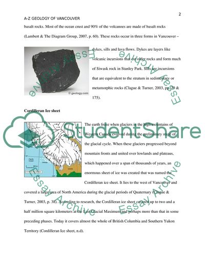
Aquifer An aquifer is a layer of porous substrate that stores, transmits and yields groundwater to wells and springs. To be an aquifer it is veryimportant that the unit should be fully saturated, has open voids or spaces and could provide sufficient amount of groundwater at fast rates to wells and springs. An aquifer can of three types – unconfined, confined or perched. The potentiality of an aquifer in a region can be determined on the basis of the permeability (capacity to transfer water) and porosity (capacity to hold water) of the geological material. The geology of a region and its soil properties play the most important role in determining the location and characteristics of an aquifer (“Groundwater storage in aquifers”, n.d). Basalt Rocks Basalt rocks are fine grained igneous rocks, black in color and rich in calcium feldspar. These rocks are comprised of minerals plagioclase feldspar, pyroxene, olivine, and magnetite. The partial melting of the chief rock of the upper mantle, periodite leads to the formation of the basalt rocks. Most of the ocean crust and 90% of the volcanoes are made of basalt rocks (Lambert & The Diagram Group, 2007, p. 60). These rocks occur in three forms in Vancouver – dykes, sills and lava flows. Dykes are layers like volcanic incursions that cut older rocks and form much of Siwask rock in Stanley Park. Sills are incursions that are equivalent to the stratum in sedimentary or metamorphic rocks (Clague & Turner, 2003, pp. 29 & 175). Cordilleran Ice sheet The earth froze when glaciers in the high mountains of Western Canada evolved during the preliminary stage of the glacial cycle. When these glaciers progressed beyond mountain fronts and united over lowlands and plateaus, which happened over a span of thousands of years, an enormous sheet of ice was created that was named the Cordilleran ice sheet. It lies to the west of Vancouver and covered a large area of North America during the glacial periods of Quaternary (Clague & Turner, 2003, p. 38). According to research, the Cordilleran ice sheet covered up to two and a half million square kilometers at the Last Glacial Maximum and perhaps more than that in some preceding phases. Today it covers almost the whole of British Columbia and Southern Yukon Territory (Cordilleran Ice sheet, n.d). Debris Flows Under the force of gravity, moving masses of sand, rocks, soil, loose mud, water and air are transported down steep slopes which are called the debris flows. These substances which can be anything from finely powdered rocks to mighty boulders are also pushed down by melting glaciers and ice sheets. The debris casted off by glaciers is generally an unsorted heap of stones and rocks entrenched in a sandy, clayey medium and are known as till or boulder clay. Some debris flows are slow making small internal movements of just one to two feet per year. However, some flows are very fast – travelling down with a speed of 100 miles per hour in regions with very steep slopes. Debris flows with high speed as well as large volumes are very dangerous and are responsible for killing number of people every year worldwide (“What is a debris flow?”, n.d). Erosion Weathered materials and loose soil lack resistance power and therefore, are easily piled and transported by wind or rain to large distances. There are various agents of erosion – rain, running water, gravity, glaciers and wind. These agents carry weathered materials over long distances before finally dumping them as layers of sediments on earth’s surface. Soil is removed as fast as it is formed when all these eroding agents work together. This is the reason we find soil to be only a few meters thick or less in nearly all parts of the world (Thompson & Turk, 2005, p. 247). Fraser River The Fraser river starts flowing from near mount robs ton situated in the western slope of the Rocky Mountains in central British Columbia, travels southwest before joining in the Pacific Ocean. It covers an area of 1400 kms and is sustained by a 220000 kms large drainage area. Fraser River is the longest river of British Columbia. It discharges 112 cubic kilometers of water along with 20 million tons of sediment into the Pacific Ocean each year. The Fraser river basin which includes the river, streams and its estuary are one of the most productive regions on earth. Moreover, they provide shelter to abundance of fishes and wildlife and are responsible for almost 80% of economic production of British Columbia. However, urbanization, industrial development and increasing stipulation for natural resources are polluting the river enormously (“The Fraser River”, n.d). Glaciers Glaciers are formed in places which are cold throughout the year and snowfall can happen unexpectedly anytime around the year. There is lot of air between the flakes during the initial snow fall. During the subsequent snow falls, snow gets packed together, become heavier and the flakes start losing their shape. Gradually the air comes out of the flakes turning them into ice. As a result, water gets absorbed in the places emptied by air giving a round shape to the snow pack. With the passage of time these ice fields grow deeper and stronger before becoming a glacier (“Glaciers”, n.d). Hydrothermal vents A hydrothermal vent is a fissure in the surface of the planet from which geothermal heated water releases. These vents are mostly found near volcanically active places, regions where tectonic plates are drifting apart, hotspots, and ocean basins. The ecological vigor of the earth and the presence of enormous amount of water on its surface and inside its crust make the existence of hydrothermal vents possible. Hot springs, geysers and fumaroles are some of the common types of vents present today. The hydrothermal vents found in regions around the submarines have been found to be biologically more productive. The Jupiter’s moon Europa has been guessed to have some active hydrothermal vents and planet mars too have been speculated to have ancient hydrothermal vents (“Hydrothermal Vents”, n.d). Ice Age The Ice Age existed for around 25,000 years during which one third was of the earth was covered with ice. During this age, ice spread to different parts of the world and sheets of ice covered rivers and valleys. In this period, ice melted but froze again. According to scientists, the last ice age was approximately 10, 000 years ago. The ice had started melting due to warming up of the earth bringing the ice age to an end. The ice age left behind glaciers as a mark of its existence. The ice and glaciers we see today on high mountains are the only ice left over by the ice age (“Glaciers, n.d”). Juan de Fuca Strait The Strait of Juan de Fuca forms the regional international boundary between Canada and the U.S. It connects the Puget Sound and the Strait of Georgia to the Pacific Ocean. Its length is 102 miles approx. and width 10-18 miles. The Strait has been named after the legendary Greek mariner, Juan de Fuca, who had discovered this region in the late 16th century. This strait is under the direct influence of the westerly winds and the Pacific waves as a result of which its cold water is always thick with fog and much coarser than the secluded waters of Puget Sound and the inner shoreline of British Columbia and the U.S (“Strait of Juan de Fuca”, n.d). Karst topography The geographical structure formed as a consequence of the dissolution of a layer or layers of soluble rock which is generally carbonate rock such as limestone or dolomite is called Karst topography. Weathering defiant rocks, such as quartzite have also been found to lead to the formation of this topography, though in the correct surroundings. Such topography has limited surface water because of its subterranean drainage. Cenotes, sinkholes or dolines are some of the distinctive surface features present in Karst regions. However, these features are totally missing where the soluble rock is mantled. Even, thousand of caves have been found in some of the Karst regions (“Karst”, n.d). A Karst landscape in France Land slides Land slide is the common term used for mass wasting and the landforms created by mass wasting. When the earth materials are moved down the slope mainly under the influence of gravity, it is called mass wasting. Though the force of gravity is present all the time on the slopes, the earth materials are held in their place due to the strength of rocks and soil. However, natural processes or human activity leads to destabilization of the slope in some regions resulting in a landslide. The main factors triggering landslides are rain, melting snow, streams and even leaking irrigation ditches. Landslides are a common sight in hilly and mountainous regions due to the vulnerability of the slopes here. They also occur in earthquake prone regions and volcanically active areas (Lambert & The Diagram Group, 2007, p. 247). Mount Garibaldi Mount Garibaldi is located northeast of Squamish on the southwest corner of Garibaldi Park in British Columbia. It is 2675 m (8776 ft) in height and is flanked by the Garibaldi lake area in its north and the Diamond Head area in the south. It has four ranges named – Pacific Cordillera, Coast Mountains, Garibaldi Neve, and the Pacific ranges. Garibaldi Neve, is a small ice field situated in the east of the mountain range and is often traversed as a 2or 3 day ski trip. It is perhaps the first alpine peak to be climbed in the Coast Mountains (Dalton, A., Dalton, W., King, Pattison, Trorey &Warren, 1907) North American Plate The tectonic plate casing most of North America, Greenland, Cuba, Bahamas, and parts of Siberia, Japan and Iceland is called the North American plate. In the east it stretches up to the Mid-Atlantic ridge and in the west up to the Chersky Range in Eastern Siberia. A broad core called a craton is present in the interiors of the key continental landmass. In the extensive duration of geological time, the tectonic activities left rubble of crustal materials called terranes beside the edges of the craton. According to research, these terranes make most of area of North America lying to the west of the Rockies. Moreover, this plate includes both continental and oceanic crust. (“North American Plate”, n.d). Oceans An ocean is a large body of saline water which covers almost 70% of the surface of earth. A large portion of the planet’s hydrosphere that is, around 97% of earth’s water is in the oceans. There are four main oceans – Pacific, Atlantic, Indian and the Arctic Ocean. A fifth one had been added, the Southern Ocean, by the International Hydrographic Organization in the year 2000. The oceans play a major role in modulating the weather and temperature on earth. Firstly, they absorb the incoming solar radiation as heat energy, thereby helping in moderating the earth’s temperature. Then this heat energy is distributed all around the globe along with the ocean currents as a result of which land and air are heated in winters and cooled during summers (“The Oceans”, n.d). Pyroclastic flows Fluidized heaps of rock fragments and gasses which move speedily under the influence of gravity are called the Pyroclastic flows. There are different actions that give rise to Pyroclastic Flows – for example, when an eruption column subsides or an detonation on a lava dome or lava flow, or even as a result of gravitational collapse. The water and gas from the eruption, water vapor from melted snow and ice, and air from the flow superseding air moving down slope leads to the fluidization of the Pyroclastic flows. These flows consist of 80% of unconsolidated material and are denser than the pyroclastic surges. Two types of pyroclastic flows exist – Ignimbrites and Nuees Ardentes. These flows move at a very high speed – the small ones are as fast as 10 to 30 m/s while the larger ones can move at speed rates of 200 m/s. Moreover, they are very hot and can easily blaze down manmade structures, vegetation, and even, human skin (Riley, n.d). Quakes A quake also called an earthquake or a tremor happens as a result of an unexpected release of energy on the earth’s crust which generates seismic waves. In general, any seismic activity which occurs naturally (geological faults, volcanic activities and landslides) or, are caused by humans (mine blasts and nuclear tests) is referred as a quake. Smaller earthquakes which are less than 5 points are measured on the Richter scale while the large ones which are above 5 points are measured on Moment Gratitude. Earthquakes patent themselves by shaking, leading to dislocation of the ground on the earth’s surface. If the epicenter of the earthquake is located offshore, it causes a tsunami. They are also responsible for eliciting landslides and volcanic activities. Quakes cause large scale damage to human life and material on earth (“Earthquakes”, n.d). Rock fall The rolling or bouncing of large fragments of rocks, which might be a single large block or molders, down steep slopes is called a Rock fall. They mostly happen as a consequence of some climatic or natural event like freeze- thaw activity, heavy rains, earthquake, that causes an alteration in the forces performing on the rock. Generally, a large number of blocks bump into one another and with the ground as they hurdle down the slope. Extremely fractured or trembling rocks are most susceptible to rock falls (Clague & Turner, 2007). When the rocks are cut for highways and railways in mountainous terrains, rock falls act a major risk. Rock falls are responsible for almost 45% of all unsteady gradient problems (“Analysis of rock fall hazards”, n.d). Strait A strait is a slender, normally navigable channel of water which links two larger, navigable bodies of water. Generally, it refers to a waterway that is situated between two land masses. However, it may also refer to a navigable channel through a body of water that is otherwise not navigable, for instance, if it is too shallow, or if it contains a reef or archipelago which is not navigable. Straits form vital shipping routes, and are economically very necessary. Many wars have been fought to gain control over these straits. The terms channel, firth, pass or passage, and sound can be identical and used interchangeably with strait, though each (“Strait”, n.d). Tsunami When a series of huge waves strikes a coast, it leads to great devastation and loss of life and is called a Tsunami. The major events causing Tsunamis are underwater earthquakes, volcanic eruptions, submarine rockslides or in some cases by an asteroid or meteoroid crashing into the water from space. The wavelength of a Tsunami is extremely long – up to several hundred miles long. Almost 90% of Tsunamis occur in the Pacific Ocean. They are very difficult to be detected in the deep seas because of lack of visibility. In an open ocean, the speed of a tsunami can cross 970 kph; the same speed as that of a flying jet. Big Tsunamis cause huge disasters and are responsible for innumerable deaths. The use of modern technologies like seismographs, computerized offshore buoys and siren systems should be used to detect Tsunamis which could alert people and thereby save thousands of lives (Jeananda, 1996). Unconfined Aquifers Aquifers can of three types – unconfined, confined or perched. An unconfined aquifer is one which has no confining layer between the zone of saturation and the land surface. The unconfined aquifer has the capability to provide the maximum amount of water, followed by the confined aquifer. They are covered with solid rocks, or unconsolidated materials since they allow permeability. The upper surface where the rock formations are fully saturated is called the water table and therefore, these aquifers are also known as water table aquifers. Recharge is provided to them directly from the infiltration of the rainfall and surface water (American Ground Water Trust, n.d). Volcanic rocks The rocks are classified into three groups by geologists – igneous, metamorphic, and sedimentary. Igneous rocks resolve itself from magma and can be further divided into intrusive igneous rocks and extrusive igneous rocks. When the magma hardens within the crust, the rock is named an intrusive igneous rock and when the magma ejects at the surface, it is named an extrusive igneous or volcanic rock. Most of the islands are made of volcanic rocks and are available in abundant quantity. Volcanic rocks are classified by the size, abundance, and category of crystals. The rock is called asphanitic if crystals are not visible at all; however, if the crystals are plentiful, the rock is called porphyritic. Moreover, as the volcanic rocks cools quickly on the earth’s surface they are fine grained (“Volcanic Rocks”, n.d). Water falls A waterfall is a place where flowing water swiftly drops in altitude as it flows over a steep region or a cliff. Waterfalls are generally produced when the river is juvenile. They are mostly formed on rocky terrains as a result of erosion. Waterfalls can happen along the edge of a glacial trough, where a stream or river flowing into a glacier continues to flow into a valley after the glacier has dissolved. Block, cascade, cataract, chute, frozen are some of the common types of waterfalls. The world’s tallest waterfalls are the Angel Falls in Venezuela with a height of 3,212 ft (“Waterfalls”, n.d). Xenoliths Xenolith is a piece present inside an intrusive igneous rock but is completely unrelated to the igneous body. These are older pieces of rocks which were integrated into the magma when it was still in liquid form. Xenoliths are generally found near their novel position of aloofness but if the density is larger, they mend deep into the intrusion rocks. Xenoliths are typically reconstituted through the procedures of contact metamorphism, in which heat and fluids cause mineralogical and chemical changes in the parent rock of the xenoliths. Moreover, the temperature and composition of the magmatic body can be found through a study of these changes (“Xenolith”, n.d). Yrespian Stage All the rocks deposited worldwide during the Yrespian age (55.8 million to 48.6 million years ago) was signified by the oldest division of Eocene rocks and was named the Yrespian Stage. The region of Ypres in Berg gave its name to the Ypresian stage (“Ypresian Stage”, n.d). Zeolite Micro permeable crystalline solids with precise structures are called Zeolites. Their structures normally contain silicon, aluminum and oxygen while their pores include water and/or other molecules. Most of these transpire naturally as minerals, and are expansively mined in many parts of the world. The rest are synthetic which are made commercially for explicit usage, or created by research scientists who want to comprehend about their chemistry. Zeolites are used in a range of applications and have a global market of several million tons per annum because of their exclusive porous properties. In the western world, major uses are in petrochemical cracking, ion-exchange, and in the separation and removal of gases and solvents. Other applications are in agriculture, animal husbandry and construction (Bell, 2001). References Bell, R.G. (2001, May). What are Zeolites? Retrieved from http://www.bza.org/zeolites.html Clague, J.J. & Turner, B. (2003). Vancouver, City on the Edge: Living with the Dynamic Geological Landscape . British Columbia: Tricouni Press Cordilleran Ice sheet (2011, Nov. 17). Wikipedia. Retrieved from http://en.wikipedia.org/wiki/Cordilleran_ Ice_ sheet Dalton, A., Dalton, W., King, A., Pattison, T., Trorey, J.J & Warren, G. (1907). Mount Gibraldi, British Columbia. Bivouac.com. Retrieved from  http://bivouac.com/MtnPg.asp?MtnId=30 Earthquake (n.d). Wikipedia. Retrieved from http://en.wikipedia.org/wiki/Earthquake Fraser River (British Columbia) (n.d). Retrieved from http://www.aquatic.uoguelph.ca/rivers/fraser.htm Glaciers (n.d). Snowtastic Snow. Retrieved from http://library.thinkquest.org/3876/glaciers.html Groundwater Storage in Aquifers. (n.d). In Portage County Groundwater Website. Retrieved from http://www.co.portage.wi.us/groundwater/undrstnd/aquifer.htm Hoek, C. (n.d). Analysis of Rock fall Hazard [PDF document]. Retrieved from http://www.rocscience.com/hoek/corner/9_Analysis_of_rockfall_hazards.pdf Hydrothermal Vents (n.d). Wikipedia. Retrieved from http://en.wikipedia.org/wiki/Hydrothermal_vent Ice Age (n.d). Oracle: Think Quest. Retrieved from http://library.thinkquest.org/3876/iceage.html Jeananda, C. (1996). Enchanted Learning. Retrieved from http://www.enchantedlearning.com/subjects/tsunami/ Karst (n.d). Wikipedia. Retrieved from http://en.wikipedia.org/wiki/Karst Lambert, D. & The Diagram Group (2007). The Field Guide to Geology (new eds.)(p.60) USA: Infobase Publishing. North American plate (n.d). Wikipedia. Retrieved from http://en.wikipedia.org/wiki/North_American_Plate Riley, C.M. (N.D). Pyroclastic Flows. Retrieved from http://www.geo.mtu.edu/volcanoes/hazards/primer/pyro.html Strait (n.d). Wikipedia. Retrieved from http://en.wikipedia.org/wiki/Strait Strait of Juan de Fuca (n.d). World Atlas. Retrieved from http://www.worldatlas.com/aatlas/infopage/juandefuca.htm The ABC of Aquifers (n.d). American Ground Water Trust [PDF document]. Retrieved from http://www.agwt.org/info/pdfs/abcsofaquifers.pdf The Oceans (n.d). Enchanted learning. Retrieved from http://www.enchantedlearning.com/subjects/ocean Thompson, G.R. & Turk, J.( 2005). Earth Science and the Environment (4th eds.)(p. 247) Canada: Thompson Brooke/Coke Volcanic Rocks (n.d). Volcanic World. Retrieved from http://volcano.oregonstate.edu/vwdocs/vwlessons/volcanic_rocks.html Waterfall (n.d). Wikipedia. Retrieved from http://en.wikipedia.org/wiki/Waterfall What is a Debris Flow? (n.d). Geology. com. Retrieved from http://geology.com/articles/debris-flow Xenolith (n.d). Encyclopedia Britannica. Retrieved from http://www.britannica.com/EBchecked/topic/650624/xenolith Yrespian Stage (n.d). Encyclopedia Britannica. Retrieved from http://www.britannica.com/EBchecked/topic/654268/Ypresian-Stage . Read More
Cite this document
  • APA
  • MLA
  • CHICAGO
(A Geology of Vancouver Essay Example | Topics and Well Written Essays - 1750 words, n.d.)
A Geology of Vancouver Essay Example | Topics and Well Written Essays - 1750 words. https://studentshare.org/science/1767950-earth-ecology
(A Geology of Vancouver Essay Example | Topics and Well Written Essays - 1750 Words)
A Geology of Vancouver Essay Example | Topics and Well Written Essays - 1750 Words. https://studentshare.org/science/1767950-earth-ecology.
“A Geology of Vancouver Essay Example | Topics and Well Written Essays - 1750 Words”. https://studentshare.org/science/1767950-earth-ecology.
  • Cited: 0 times

CHECK THESE SAMPLES OF A Geology of Vancouver

Malaspina's Meditation on Beauty in Nature

Malaspina's Meditation on Beauty in Nature Author Name University Malaspina's Meditation on Beauty in Nature Alexandro Malaspina is remembered as an outstanding navigator.... His writings represent the farthest bounds of Europe, a task no man could have imagined in his time.... hellip; His thoughts and philosophical musings show us his maturity and steadfastness as an author....
5 Pages (1250 words) Article

A Lesion in the Motor Cortex

Brain and Mind Coursework 1.... If a patient has a lesion in the motor cortex and is unable to speak as a consequence, why is this condition NOT called aphasia?... A patient having a lesion in the motor cortex and is unable to speak as a consequence would not have aphasia but dysarthria.... hellip; First of all, aphasia usually refers to lesions of affectations of the frontal, temporal, and parietal lobes of the brain which are areas concerned with the ability to produce and comprehend language (Masdeu, 2000)....
6 Pages (1500 words) Essay

David Suzuki and Environmentalism

This essay "David Suzuki and Environmentalism" is about a book, The Big Picture, which talks about the need for conserving the planet and the environment that man lives in.... it makes clear the need for a co-existence of science and ecology.... nbsp;Suzuki's views are important also for the significance that he attributes to science....
8 Pages (2000 words) Essay

Canadain provinces

Name Instructor Date Canadian Provinces Canada has ten provinces, which are Manitoba, Quebec, Toronto, Ontario, Nova Scotia, New Brunswick, British Columbia, Prince Edward Island, Saskatchewan, Alberta and Newfoundland and Labrador.... Canada conducts its census after every five years to establish various growth parameters in the country such as demographic makeup, population structure, and religion among others....
3 Pages (750 words) Dissertation

What can phantom limb pain teach us about the human brain

Phantom limbs are legs or arms removed in the cause of an accident or by the operation by a surgeon but continue to linger in the minds of the patients indefinitely.... People with the phantom limbs experience excruciating and intense pain in the phantom arm, leg, and hand.... … What can phantom limb pain teaches about the human brain?...
5 Pages (1250 words) Essay

The Historical Formation of West Virginia

The historical formation of West Virginia has been turbulent, with environments constantly changing, shorelines shifting resulting into sea levels constantly changing and periods of tectonic stability and unstability always following each other.... In this article a specific part of the geological history of eastern West Virginia is being reported: the Devonian Period....
3 Pages (750 words) Essay

Pet Peeves Can Turn into Problems

This paper "Pet Peeves can Turn into Problems" is about a pet peeve of one person.... Of course, different people have different pet peeves.... Pet peeves are a normal characteristic in all human beings and everybody has one which others find irritating.... To be interrupted when talking is one of the most widely spread pet peeve....
2 Pages (500 words) Essay

Adjustment Letter Case Study

n 2nd, February 2015 Coastal Moves gets a delivery job with Hesse Retail group via call by Paul Mabee, vancouver Operations Manager.... Due to late delivery Coastal Moves resulting from communication failure between Bojarski and Mabee they need to apologize and give an explanation for poor communication....
2 Pages (500 words) Assignment
sponsored ads
We use cookies to create the best experience for you. Keep on browsing if you are OK with that, or find out how to manage cookies.
Contact Us