StudentShare
Contact Us
Sign In / Sign Up for FREE
Search
Go to advanced search...
Free

Delimiting the Central Business District - Case Study Example

Cite this document
Summary
The paper "Delimiting the Central Business District" highlights that the Central Business District of Saint Helier is arranged accordingly. Office buildings are located at the core of the CBD and are also taller due to lack of office space and the high rent required…
Download full paper File format: .doc, available for editing
GRAB THE BEST PAPER97% of users find it useful
Delimiting the Central Business District
Read Text Preview

Extract of sample "Delimiting the Central Business District"

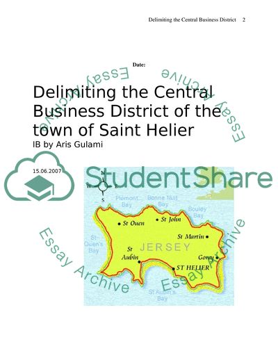
Running Head: Saint Helier town Delimiting the Central Business District of the town of Saint Helier IB by Aris Gulami 15.06.2007 Contents Aim: The aim is to determine the location of the Central Business District (CBD) on the island of Jersey, Channel Islands. Jersey is a small island (27.8 km x 14.5km) that has a population of 91,084 (July 2006 Est.) and is located between North of France and city of Portsmouth (United Kingdom) (see map 1). The town of St. Helier (see map 2) is a perfect location to analyze and delimit the CBD, as there is only one town in Jersey, where the majority of banks and retail shops will be found. The town itself is relatively small and compact and the local population is less than 25000. As the history states, the town of St. Helier used to serve as a port, but the town started to develop independently from port and its main functions are banking and tourism now (http://www.rnli.org.uk/rnli_near_you/southwest/stations/StHelierJerseyCI/history). Map 2 the map of the island of Jersey Map 1 Location of the island of Jersey Hypothesis: The CBD will contain the principal commercial streets and highly demanded land uses and forms the core of a city’s business and commercial activities (Waugh, 2002). In order to delimit the CBD, the following aspects were measured and taken into consideration: 1. The border of CBD. Within the area of CBD, the ratio of the shops in blocks to other properties is more than 1:3, meaning that over 33% of buildings in the inner CBD are expected to be department stores and specialist shops (based on evidence that over 33 per cent of buildings in the CBD are connected with retailing). In theory, inner core of CBD should contain over 10% of high-rise office blocks, commercial offices and banks. The ratio of 1:10 of offices is expected to be found in a block (based on evidence that over 10 per cent of buildings in the CBD are offices). The bid-rent theory (figure 1) describes this situation very well, where the main assumption is that in a free market the highest bidder will obtain the use of the land. The highest bidder is likely to be the one who can obtain the maximum profit from that site and so can pay the highest rent. Competition for rent is keenest in the city centre. (figure 1) 2. Land Use As the main functions of the town of St. Helier are tourism and finance, we expect banks and jewelleries to be found in the inner core of CBD and functionally grouped to increase their sphere of influence. Jewelleries will be clustered together, as it is better for the customers to have the variety choice of jewellery and this increases the urban field (hinterland). Also banks will be mainly found in the inner core of the CBD, as they are closely related to one of the main functions of the town of St. Helier – finance. Estate agents, pharmacies and news agents will be distributed on the frame or perhaps on the outer core of the CBD. News agents are low-order goods with smaller profit margins so are rarely found in the CBD, as they cannot afford to pay high rents. 3. Regarding Pedestrian Count The town of St. Helier provides workplaces for the most of the population, being the only large town on the island of Jersey; therefore we expect to have high number of pedestrians during the lunchtime, when the employees will have their break or lunchtime. Small number of customers (tourists or working-independent people) can be counted during the working hours. In this case shopping plays an important function because tourists tend to shop more in the CBD rather on the edge of the CBD. 4. Heights of the buildings All the buildings within the CBD will be taller than the other buildings close to the CBD, due to the high rent and lack of space; therefore buildings tend to grow vertically. However, we expect to find the decline in height of the buildings on the edge of CBD as buildings do not have high demand due to the easy accessibility of the CBD to customers from both sides of the island. Method: The town of St. Helier was divided on the map of the town of St. Helier with scale 1:2500 into four parts to make sure that each group of two could analyze each single building within the provided territory. Four groups had to write the amount of floors in a single building and what kind of land use (retail, residential or office) was used on the ground floor of the building. While analyzing buildings, at 13:00; 14:00 and 15:00 o’clock the pedestrians were counted in eight different locations by one of the group member for exactly five minutes. Each group had two points that were located close to main cross roads. Points were placed evenly across the study area (refer to map 1), where the most of the pedestrians were expected to be. As we were analyzing building, we had to take into the consideration five types of land uses: 1) jewellery; 2) pharmacy; 3) real estate; 4) banks and 5) newsagents and one of major aims is to calculate the nearest neighbourhood analysis (NNA) between these land uses (See graph 2) using the following formula: Rn = 2 Where: Rn = the description of the distribution  = the mean distance between nearest neighbours (km) n = the number of settlements in the study area A = the area under study (km2) These land uses are one of the factors that delimit the border of the CBD. Most of the major cities have banks, jewellers in the inner core of CBD and pharmacies, real estates and newsagents frame, or perhaps could be found on the outer core of the CBD. These land uses map out the shape of the CBD and its territory. Each single land use has different clustering (and functional grouping) and while using the NNA we can assumingly delimit the area of CBD in the town of St. Helier. Data presentation and processing Refer to map 3 to see all 8 locations. (http://www.rnli.org.uk/rnli_near_you/southwest/stations/StHelierJerseyCI/history. This data reveals that the pedestrians were counted most at the location 2(York Street), 4(New Cut) and 7(La Motte Street). At 13:00hrs the highest number of 189 pedestrians was counted at the location 2 (York Street), where the retail shops are dominating. This may be explained by employees going back to their workplaces or they may be going for have a break or lunch around this location point. On the other hand, most of the restaurants are located on the King or Queen Street, therefore some of the employees may be having lunch there, as the York Street is leading to King and Queen street. At 14:00hrs the highest number of pedestrians (144) was counted at the location 4 (New Cut), where the location point is surrounded with retail buildings. Such high number of pedestrians can be explained due to shopping reason. Local people (tourists do not tend to shop and visit Jersey Island in March, because the tourist season has not started yet) are shopping a lot during this period of time. They have just finished their lunch and they can afford to spend their time on shopping. In this case we are talking about people who work independently. They are not dependant on their administration and they are allowed to spend certain period of time on their own desire. At 15:00hrs the highest number of pedestrians (86) was counted at the location 7 (La Motte Street), where the location point is surrounded with office buildings. At 15:00 people might have some meetings and conferences, therefore to reach their final destination they have to walk by foot. Moreover, as it is city centre working people might have faced with parking problems, therefore they go the offices by foot without any problems leaving their cars in the parking lots. On the other hand, going further by La Motte Street we are able to see residential blocks. Therefore, we may say that such high number of pedestrians passed La Motte Street to get to their apartments for the personal reason. Analysis We can see that as it keeps getting late, the number of people counted at the designated location decreases and people are getting out of the CBD. At 13:00hrs the majority of the population are either going for lunch or going to the office, as we can see at location 2(York Street), 4(New Cut) and 7(La Motte Street). At 14:00hrs most of the people are going for shopping as seen in location 4 (New Cut). And at 15:00hrs the populace are either going for office meetings or home as seen at location 7 (La Motte Street).Therefore the CBD is arranged inn the required order by having the work offices at the core, retail blocks at the centre and residential buildings at the outer core. Conclusion As observed above, the CBD of Saint Helier is arranged accordingly. Office buildings are located at the core of the CBD and are also taller due to lack of office space and the high rent required. The outer core of the CBD having shorter buildings which are mainly residential are quite adequate since there is enough space and the rent is not quite as high. References: St. Helier-Jersey Island Virtual Villages, Retrieved September 13, 2007 from http://www.rnli.org.uk/rnli_near_you/southwest/stations/StHelierJerseyCI/history. Waugh, D. (2002). Geography An Integrated Approach, Nelson Thornes. Read More

3. Regarding Pedestrian Count The town of St. Helier provides workplaces for the most of the population, being the only large town on the island of Jersey; therefore we expect to have high number of pedestrians during the lunchtime, when the employees will have their break or lunchtime. Small number of customers (tourists or working-independent people) can be counted during the working hours. In this case shopping plays an important function because tourists tend to shop more in the CBD rather on the edge of the CBD. 4. Heights of the buildings All the buildings within the CBD will be taller than the other buildings close to the CBD, due to the high rent and lack of space; therefore buildings tend to grow vertically.

However, we expect to find the decline in height of the buildings on the edge of CBD as buildings do not have high demand due to the easy accessibility of the CBD to customers from both sides of the island. Method: The town of St. Helier was divided on the map of the town of St. Helier with scale 1:2500 into four parts to make sure that each group of two could analyze each single building within the provided territory. Four groups had to write the amount of floors in a single building and what kind of land use (retail, residential or office) was used on the ground floor of the building.

While analyzing buildings, at 13:00; 14:00 and 15:00 o’clock the pedestrians were counted in eight different locations by one of the group member for exactly five minutes. Each group had two points that were located close to main cross roads. Points were placed evenly across the study area (refer to map 1), where the most of the pedestrians were expected to be. As we were analyzing building, we had to take into the consideration five types of land uses: 1) jewellery; 2) pharmacy; 3) real estate; 4) banks and 5) newsagents and one of major aims is to calculate the nearest neighbourhood analysis (NNA) between these land uses (See graph 2) using the following formula: Rn = 2 Where: Rn = the description of the distribution  = the mean distance between nearest neighbours (km) n = the number of settlements in the study area A = the area under study (km2) These land uses are one of the factors that delimit the border of the CBD.

Most of the major cities have banks, jewellers in the inner core of CBD and pharmacies, real estates and newsagents frame, or perhaps could be found on the outer core of the CBD. These land uses map out the shape of the CBD and its territory. Each single land use has different clustering (and functional grouping) and while using the NNA we can assumingly delimit the area of CBD in the town of St. Helier. Data presentation and processing Refer to map 3 to see all 8 locations. (http://www.rnli.org.uk/rnli_near_you/southwest/stations/StHelierJerseyCI/history.

This data reveals that the pedestrians were counted most at the location 2(York Street), 4(New Cut) and 7(La Motte Street). At 13:00hrs the highest number of 189 pedestrians was counted at the location 2 (York Street), where the retail shops are dominating. This may be explained by employees going back to their workplaces or they may be going for have a break or lunch around this location point. On the other hand, most of the restaurants are located on the King or Queen Street, therefore some of the employees may be having lunch there, as the York Street is leading to King and Queen street.

At 14:00hrs the highest number of pedestrians (144) was counted at the location 4 (New Cut), where the location point is surrounded with retail buildings. Such high number of pedestrians can be explained due to shopping reason. Local people (tourists do not tend to shop and visit Jersey Island in March, because the tourist season has not started yet) are shopping a lot during this period of time. They have just finished their lunch and they can afford to spend their time on shopping. In this case we are talking about people who work independently.

Read More
Cite this document
  • APA
  • MLA
  • CHICAGO
(Delimiting the Central Business District Case Study Example | Topics and Well Written Essays - 11500 words, n.d.)
Delimiting the Central Business District Case Study Example | Topics and Well Written Essays - 11500 words. https://studentshare.org/geography/1709142-delimiting-the-central-business-district-of-the-town-of-saint-helier
(Delimiting the Central Business District Case Study Example | Topics and Well Written Essays - 11500 Words)
Delimiting the Central Business District Case Study Example | Topics and Well Written Essays - 11500 Words. https://studentshare.org/geography/1709142-delimiting-the-central-business-district-of-the-town-of-saint-helier.
“Delimiting the Central Business District Case Study Example | Topics and Well Written Essays - 11500 Words”. https://studentshare.org/geography/1709142-delimiting-the-central-business-district-of-the-town-of-saint-helier.
  • Cited: 0 times
sponsored ads
We use cookies to create the best experience for you. Keep on browsing if you are OK with that, or find out how to manage cookies.
Contact Us