StudentShare
Contact Us
Sign In / Sign Up for FREE
Search
Go to advanced search...
Free

Hyperspectral Remote Sensing Technology in Intelligent Buildings & Engineering - Research Paper Example

Cite this document
Summary
Hyperspectral remote sensing is one of the emerging technologies with a wide range of applications in a diverse number of fields including the intelligent buildings and engineering in recent years. The technology particularly involves collecting and processing of information or images across narrow electromagnetic spectrum using remote sensors such as cameras…
Download full paper File format: .doc, available for editing
GRAB THE BEST PAPER95.7% of users find it useful
Hyperspectral Remote Sensing Technology in Intelligent Buildings & Engineering
Read Text Preview

Extract of sample "Hyperspectral Remote Sensing Technology in Intelligent Buildings & Engineering"

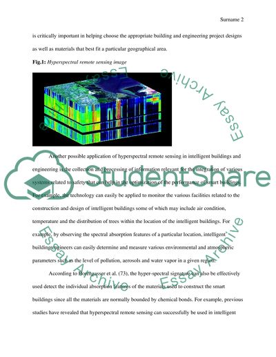
Other (s) Hyperspectral Remote Sensing Technology in Intelligent Buildings & Engineering Hyperspectral remote sensing is one of the emerging technologies with a wide range of applications in a diverse number of fields including the intelligent buildings and engineering in recent years. Also known as imaging spectroscopy, the technology particularly involves collecting and processing of information or images across narrow electromagnetic spectrum using remote sensors such as cameras, films and other digital instruments. This is normally done in order to find the spectrum of each pixel of the image for purposes of identifying materials, finding objects or detecting various processes. In Intelligent Buildings & Engineering, Hyperspectral Remote Sensing Technology is primarily being used to provide an effective means of monitoring and analysis of various real-time data that can help enhance the operational efficiency and reduce costs and energy expenses of smart buildings thereby making them to be more comfortable, safe, and healthy as well as enhance the productivity of the occupants. Unlike multispectral imaging which normally deals with numerous images at discrete, narrow bands, Hyperspectral remote sensing is primarily based on narrow spectral bands produced over a continuous spectral range. This is critically important as it makes the images more detailed. One of the areas of intelligent building and engineering where hyoerspectral remote sensing imaging can be used is to make buildings safer and more comfortable by providing reliable geological and rock information, seismic and environmental data regarding the construction sites prior to the commencement of the construction of the buildings. Generally, this is critically important in helping choose the appropriate building and engineering project designs as well as materials that best fit a particular geographical area. Fig.1: Hyperspectral remote sensing image Another possible application of hyperspectral remote sensing in intelligent buildings and engineering is the collection and processing of information relevant for the integration of various systems related to safety that can help in the optimization of the performance of smart buildings. For example, the technology can easily be applied to monitor the various facilities related to the construction and design of intelligent buildings some of which may include air condition, temperature and the distribution of trees within the location of the intelligent buildings. For example, by observing the spectral absorption features of a particular location, intelligent building engineers can easily determine and measure various environmental and atmospheric parameters such as the level of pollution, aerosols and water vapor in a given region. According to Borengasser et al. (73), the hyper-spectral signature can also be effectively used detect the individual absorption features of the materials used to construct the smart buildings since all the materials are normally bounded by chemical bonds. For example, previous studies have revealed that hyperspectral remote sensing can successfully be used in intelligent building and engineering to identify asbestos-containing roofs thereby enabling the engineers to take appropriate measures. Some of the other important information of the building construction sites that can be collected and analyzed through the technology includes changes in the surrounding vegetation, water of soil and air condition. This kind of information is particularly important in the development of a more comfortable working or operating environment for the would-be occupants and tenants of the building. On the other hand, the spatial information obtained through hyperspectral remote sensing can also effectively be used to in the planning and development of intelligent buildings to help improve lighting, security and other key installations needed in an intelligent building (Rashed 352). In order to make buildings more livable and meet the relevant standards, smart building engineers can employ the use of hyperspectral remote sensing technology to develop spatial maps that are critical in the planning of population centers, traffic, and drainage and utility networks among others. Finally, hyperspectral remote sensing technology is important in impervious surfaces know-how especially regarding the geometry, magnitude, spatial patterns of perviousness-imperviousness ration and impervious surfaces patterns; are significant considerations in the remote sensibility constructions. The knowledge on impervious engineering structure surfaces provides a wide-ranged themes and issues necessary in global environmental change, environmental engineering field and human milieu interactions (Lagaris 145). A key futuristic aspect of this remotes classifier is its intelligent ability to use highly-regarded dimensional data with unusual resources to a feature sensible selection step which adversely reduce the data presented dimensionality. For this intelligence engineering structural design, the hyperspectral data application is achieved through hundreds of hundreds contagiously spectral channels. Generally, remote sensing of impervious surfaces’ structures in engineering structures has in the recent past attracted unpredicted attention in the engineering field. Data/remote fusion ensures a perfect extraction and estimation of impervious surfaces. Mapping requirements of these impervious surfaces in hyper spectral sensing technology in intelligent buildings and engineering structures impacts on the spatial, spectral, geometric and time-based solutions on the mapping estimates addressed. Pixel-based inclusive of regression and image classification and sub-pixel based approaches such as linear spectral un-mixing provides for an object oriented algorithms special resolution and landscaping contextualized classification methods. Multimedia hyper spectral remote sensing technology in intelligent buildings and engineering structures: An example of a multimedia hyper spectral engineering structure is the support vector machine. The support vector machine structurally paves way technologically for a newly initiated way to design classification sensory algorithms which learn exceptionally from examples (Chang 111). The learning examples from these technologically advanced structures include supervised sensory learning which are generalised during intelligence remote sensing application of new data. The technological remote sensibility success of support vector machines in relation to difficult intelligence classifications problems from hyper spectral remote sensing has been structurally recorded higher performance. In conclusion, hyperspectral remote sensing is an important new technology that has numerous applications in the field of intelligent buildings and engineering. Although the technology was originally developed for geology and mining, it is increasingly being used in a wide range of areas such as to provide an effective method of monitoring and analysis of various real-time data that can help enhance the operational efficiency and reduce costs and energy expenses of smart buildings thereby making them to be more comfortable, safe, and healthy and enhance the productivity of the tenants. Works Cited Borengasser Marcus, Hungate William S., Watkins Russell. Hyperspectral Remote Sensing: Principles and Applications Principles and Applications. New York: CRC Press, 2007. Print. Chang, Cheng-Wen, et al. "Near-infrared reflectance spectroscopy–principal components regression analyses of soil properties." Soil Science Society of America Journal 65.2 (2001): 480-490. Lagarias, Jeffrey C., et al. "Convergence properties of the Nelder--Mead simplex method in low dimensions." SIAM Journal on optimization 9.1 (2008): 112-147. Rashed, Tarek. “Remote sensing of within-class change in urban neighborhood structures.” Comput. Environ. Urban Syst., 32.5(2008): 343-354. Print. Read More
Cite this document
  • APA
  • MLA
  • CHICAGO
(“Hyperspectral Remote Sensing Technology in Intelligent Buildings & Research Paper”, n.d.)
Hyperspectral Remote Sensing Technology in Intelligent Buildings & Research Paper. Retrieved from https://studentshare.org/design-technology/1677881-hyperspectral-remote-sensing-technology-in-intelligent-buildings-engineering
(Hyperspectral Remote Sensing Technology in Intelligent Buildings & Research Paper)
Hyperspectral Remote Sensing Technology in Intelligent Buildings & Research Paper. https://studentshare.org/design-technology/1677881-hyperspectral-remote-sensing-technology-in-intelligent-buildings-engineering.
“Hyperspectral Remote Sensing Technology in Intelligent Buildings & Research Paper”, n.d. https://studentshare.org/design-technology/1677881-hyperspectral-remote-sensing-technology-in-intelligent-buildings-engineering.
  • Cited: 0 times

CHECK THESE SAMPLES OF Hyperspectral Remote Sensing Technology in Intelligent Buildings & Engineering

Business Intelligence Technology Issues

The technology that is used to deploy the business intelligent practices is ever changing.... The organization of data results in timely implementation of Business intelligent protocols often resulting in their implementation delay and eventually failure.... This cannot be acceptable as proficiency in time is the key issue in business intelligent systems.... The data required for the business intelligent systems may not be resource-able....
3 Pages (750 words) Assignment

The Forms of Remote Sensing

remote sensing techniques Institutional Affiliation: Introduction remote sensing refers to the process of acquiring information about a phenomenon or an object without making contact physically with the object.... There are two major forms of remote sensing.... They are: Passive remote sensing.... Active remote sensing.... Passive remote sensing involves detection of natural radiation that is reflected or emitted by the surrounding areas or the object....
7 Pages (1750 words) Research Paper

Information Extraction(Remote Sensing and Image Analysis)

remote sensing in the most generally accepted meaning refers to instrument-based techniques employed in the acquisition and measurement of spatially organized (most commonly, geographically distributed) data/information on some property(ies) (spectral; spatial; physical) of… array of target points (pixels) within the sensed scene that correspond to features, objects, and materials, doing this by applying one or more recording devices not in physical, intimate contact with the item(s) under surveillance (thus at a finite distance from the observed remote sensing and image analysis Samson Varghese remote sensing and image analysis “remote sensing in the most generally accepted meaning refers to instrument-based techniques employed in the acquisition and measurement of spatially organized (most commonly, geographically distributed) data/information on some property(ies) (spectral; spatial; physical) of an array of target points (pixels) within the sensed scene that correspond to features, objects, and materials, doing this by applying one or more recording devices not in physical, intimate contact with the item(s) under surveillance (thus at a finite distance from the observed target, in which the spatial arrangement is preserved); techniques involve amassing knowledge pertinent to the sensed scene (target) by utilizing electromagnetic radiation, force fields, or acoustic energy sensed by recording cameras, radiometers and scanners, lasers, radio frequency receivers, radar systems, sonar, thermal devices, sound detectors, seismographs, magnetometers, gravimeters, scintilla meters, and other instruments(The Concept of remote sensing) remote sensing is mostly used to study objects or a particular area on earth using the photographs taken by the remote satellites stationed above the earth....
2 Pages (500 words) Essay

Remote Sensing Workflow

The paper "remote sensing Workflow" presents detailed information, that the planet-Earth is full of many adventures and natural phenomena, that we are still unfamiliar with, despite our innumerable efforts to proceed in the field of science and technology.... According to (Canada Centre for remote sensing, n.... he first condition without which, the process of remote sensing can not take place, is the provision of electromagnetic energy as waves to a specific place or to a study area....
6 Pages (1500 words) Essay

Remote Sensing

remote sensing Q The bright color at A shows an area on the earth surface without vegetative cover.... Signal And Image Processing For remote sensing.... This assignment paper talks about the topography of mountainous areas and discusses if these areas have or not the vegetative cover, the liquids such as natural gas or body of water like the existence of the lake, mountain tops and if they are similar to each other....
1 Pages (250 words) Assignment

Intelligent Building

intelligent buildings help people work more effectively and efficiently and it is, therefore, easy to cope with the social and technological changes.... These intelligent buildings are designed by the architectures those have knowledge and skills on the same and not anyone who can do that.... engineering are a scientific principles or professional art as well as the practical knowledge applied in designing of structures, machines and construction....
9 Pages (2250 words) Assignment

Interpretation of Drones

For instance in this topic, a researcher should come up with the following parts: The introduction whereby the researcher defines and elaborates… Drones assist scientific researchers in the topic of remote sensing because the do not involve human pilot.... Some of the remote sensing data include multispectral data, satellite imagery, space sensing and digital elevation data.... remote sensing images are put in digital images....
7 Pages (1750 words) Research Paper

Remote Sensing and Image Processing

This essay "remote sensing and Image Processing" discusses the process of obtaining information about the earth's surface from an overhead perspective.... he signal commonly used in remote sensing is electromagnetic radiation.... For remote sensing, the commonly used ranges of the electromagnetic spectrum are visible light, infrared, and microwave (Lillesand et al....
6 Pages (1500 words) Essay
sponsored ads
We use cookies to create the best experience for you. Keep on browsing if you are OK with that, or find out how to manage cookies.
Contact Us